Grid reference TQ3488
near to Tottenham, Haringey, England
Coverage
We have
200 images
in grid square TQ3488
Contribute
Explore gridsquare TQ3488
Surrounding area
Sample images
Breakdown list
images taken from TQ3488 [5]
A sample of 12 photos from 200
for TQ3488
- View this square in the Browser >>>

|
Markfield Road, Tottenham (set of 2 images) |

|
View of the Markfield Beam Engine at rest #2
by Robert Lamb
Looking north-northwest.
|

|
By Warwick Reservoir East
by Neil Theasby
At Walthamstow Wetlands
|

|
Wildlife, Walthamstow Wetlands
by Jim Osley
|

|
Gladesmore Road, South Tottenham (set of 2 images)
by David Howard
|

|
Canal, South Tottenham
by John Davies
Here the Lee Navigation takes a change in direction from roughly north to roughly north-east, midway between Springfield Marina and Tottenham Hale.
|

|
Black Crane at Oak Wharf timberyard, South Tottenham
Timber used to be unloaded from boats on the River Lea into the yard. A sign by the crane asks people to oppose its demolition to make way for flats.
|

|
Very low railway bridge on Coppermill Lane
Actually two bridges side by side, the nearer one has had its track lifted. It is no longer a public route for vehicles.
|

|
Railway bridge on Markfield Road, Tottenham (set of 2 images)
by David Howard
|

|
Markfield Park
by Marathon
Markfield Park forms part of the floodplain of the River Lea and is alongside the River Lee Navigation - see Link
There are two watercourses in the park - the Old Moselle Brook which runs adjacent to... (more)
|

|
Cycle path near Walthamstow
The small blue sign indicates that this path is part of National Cycle Network route 1.
|

|
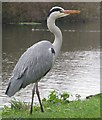
Heron by the River Lea |
Explore more images in this square: | View Filtering options | View all 200 images page by page >>> |
|
