Houston will flood again, like it always does.

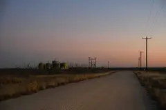
What will it take to fix the Houston floods? A lot. It mostly comes down to making space for the water and investing in drainage infrastructure. Pictured: Construction crews work to expand Brays Bayou, Thursday, Dec. 29, 2016, in Houston.
Rain will back up storm drains, bayous will overflow, water will wreck thousands of homes and people may die. There will be calls for drastic action, but time will pass, and the urgency to respond will fade.
Then Houston will flood again, like it always does.
Advertisement
Article continues below this ad
But the solutions are out there.
"We literally know how to eliminate flooding," said Wayne Klotz, a veteran Houston flood engineer and past president of the American Society of Civil Engineers.
The problem, said Houston flood czar Steve Costello, is that the public's zeal for protection – and the hefty investment it would require – only thrives while the destruction is fresh.
What needs to be decided is how far taxpayers are willing to go. Cars don't have airbags to absorb a hit from a train. Should Houston have a drainage system to contain a biblical storm? Where does the city draw the line?
"We would love to design the ultimate system," said Carol Haddock, deputy director of the engineering and construction division at Houston's Department of Public Works and Engineering. "It depends on funding."
Advertisement
Article continues below this ad
That's where Costello comes in. Last year, by mayoral appointment, he became the city's first-ever official in charge of flooding, a move prompted by storms in 2015 and 2016.
Costello and others believe the city must take action. Houston rains are trending harder, and the sprawl of dense development exacerbates the inundations, according to a 2014 ASCE report on urban flooding.
"If something is not done to reduce the risk," the report said, "we are passing on to succeeding generations a potentially insurmountable problem."
****

The Wimbledon Champions Park subdivision is inundated by floodwaters in the Cypresswood area on Tuesday, April 19, 2016, in Houston.
Brett Coomer/Houston ChronicleThe costs of flooding aren't just measured in dollars and cents.
Advertisement
Article continues below this ad
Robert Arnold, a 76-year-old retired engineer, moved in with his daughter as his damp, moldy house in northwest Harris County sat for months awaiting federal flood insurance funds. Tim Ryan, an engineer in oil and gas, moved his family to an apartment, which he rents while "going broke," draining $35,000 from savings to pay taxes and repair costs on his twice-flooded house in Meyerland.
After 4 feet of water covered that West Houston neighborhood in 2015, therapist Gayle Kamen started a group for owners of flooded homes.
"I had a couple people say they were so depressed, they wanted to commit suicide," she said. "They saw no end."
Meyerland flooded again in 2016.
In Greater Houston, almost no home is safe. While the most recent storms hit the region's west and northwest, a tally of flood damage over three decades shows potential anywhere heavy rain falls, even outside floodplains.
Advertisement
Article continues below this ad

A tally of flooded properties between 1979 and 2015 shows the trouble happens wherever rain falls. Image courtesy of Harris County Flood Control District
Decades of decisions created this problem. By the time planners made maps in the mid-1980s to show that low-lying areas beside waterways were prone to flooding, those areas were full of buildings and inadequate drainage systems.
Until the 1980s, engineers designed pipes and roadside ditches to capture a "three-year flood," a relatively modest storm, said Andres Salazar, managing director of water resources at Walter P. Moore and Associates, an engineering firm that designs drainage projects for the city.
Today, engineers design for the 100-year flood – about 13 inches of rain over 24 hours on any spot in Harris County – which they calculated by running statistical analysis on about 150 years of rainfall data.
Advertisement
Article continues below this ad
But once-in-a-century storms have hit eight times in the last 27 years. Rainfall in the northwest part of the county on Tax Day 2016 qualified as a once-in-a-millennium storm, according to statistical models.
Virtually none of Houston's old pipes meet even the 100-year standard. As the city grows denser, the drainage system falls further behind.
Within a block of his home in the Heights, said Harris County engineer John Blount, three bungalows have been replaced in the last year by townhomes three times their size. Where lawns once held standing water, steep roofs now cast it swiftly into storm drains.
One or two new buildings have little impact, Blount said, but the "cumulative effect" of thousands can make a difference.
"It's nobody's fault necessarily, but now something has to be done," Blount said.
It's a tremendous effort, but not without precedent.
The Netherlands, for example, responded to a disastrous 1953 flood with a 50-year endeavor to build 14 great barriers and dams, now collectively known as a wonder of the modern world.

A storm surge barrier in the Netherlands, built as part of that country's Delta Works program.
Here in Houston, a spate of floods in 1979, which included Tropical Storm Claudette, inspired the Harris County Flood Control District to computerize the drainage system and institute the first drainage standards for private development. Neighborhoods built under those rules have largely avoided devastation.
During that era, Mike Talbott joined the district as an engineer. When he retired as executive director in August, he said he hoped the double blow of '15 and '16 would inspire a similar legacy.
"There are just two things you can do with water," Talbott said. "You can move it or you can store it."
****
Houston maintains 2,900 miles of roadside ditches, 3,600 miles of storm sewer pipes, plus 120,000 sewers, roadway grates and other inlets for floods to enter the system.
They all lead to Harris County's 2,500 miles of above-ground waterways, which empty into Galveston Bay.
Homes flood because that system backs up or overflows. To fix this problem, pipes and waterways that are too small will have to be replaced.
That effort has been underway since the city in 1999 made its first "comprehensive drainage plan," which prescribed about $2.7 billion in upgrades. Under Mayor Lee Brown, a move to fund the plan failed. Under Mayor Bill White, the city approved $150 million over three years for drainage spending.
As a city councilman, Costello championed ReBuild Houston, a program adopted in 2010 that called for a dedicated tax to pay for repairs, bucking the debt-funded approach.
ReBuild lumps street and drainage repairs into a single, prioritized list: might as well fix both if you have to rip up the streets to get to the pipes. ReBuild also builds streets low and slopes them toward waterways, to help with drainage. Since 2012, when the program began in earnest, the city has improved about 900 miles of infrastructure, most of it street work, according to city figures; it plans 154 more miles of drainage improvements by 2021.

Drainage projects currently scheduled by the City of Houston
But water running through new big pipes ultimately flows out small holes, intentionally installed so as not to overwhelm the bayous. To receive more water, the bayous need to grow.
The county relies on federal partnerships to fund the biggest of those efforts, and progress has been slow. Five projects were authorized between 1986 and 1990 with plans to widen some 60 miles of bayou and build on their banks 11 new basins, covering about 1,500 acres. One project, Sims Bayou, was finished in 2015. It's the only one. A project on Greens bayou is 5 percent complete.
The biggest project, Brays Bayou, was initially scheduled for completion in 2014, but has been pushed back to 2021.

Construction crews work to expand Brays Bayou, Thursday, Dec. 29, 2016, in Houston.
Jon Shapley/Houston ChronicleWhen Congress banned earmark funding in 2011, the reliable stream of money to the bayou projects faded. Now the district builds a small segment and submits an invoice for reimbursement. The review process has no time frame or guarantee. Construction of subsequent segments depends on that check in the mail.
Congressman Al Green, D-9th district, said he plans to introduce legislation to restore a type of earmark funding, and with it, reliable sponsorship of the bayou projects.
But those projects are only a start.
In the 2000s, the flood control district used airborne laser scanners to image the drainage system and calculate what it would take to expand to handle a 100-year storm across the entire county. It found that county waterways provided greater than 50-year flood protection to about 41 percent of the county, and less than two-year protection to about 47 percent.
Upgrading the whole system to 100-year protection would include costs of buying 30,000 acres of adjacent land, rerouting thousands of utilities, widening thousands of bridges, digging 8.7 billion cubic feet of earth from the channels and more. Price tag: $27 billion. At the district's current rate of spending, that would take about 400 years.
Until then, said Haddock with public works, "we can't just dump more water in the bayous."
But it's got to go somewhere.
****
Where to dump it? That was the question the city set out to answer with a commissioned report in 2008. Forty-nine drainage projects, billed at $281 million, were slated for completion by 2013. But if those projects poured into the bayous, the bayous would overflow during severe rains.
So the report identified four sites at public parks, totaling about 80 acres, that could be converted into stormwater storage ponds for 13 drainage projects.
SEE THEM HERE: Recommended sites for detention ponds from 2008 report
Turning a park into a pond involves digging it out, surrounding it with a 30-foot-wide berm and building a short canal to the nearest bayou. The ponds don't receive water from new city projects directly; they link into the bayous to absorb the equivalent load. But the ponds recommended in the 2008 report were never built. Smaller-scale detention was built at each drainage project, the city said.
Whenever the city or other local entity builds a stormwater pond, officials hand it over to the flood control district. The district maintains 200 basins, totaling 15,690 acres, about 1.4 percent of the total county area.
The county would need about 52,000 more acres of detention space to achieve countywide 100-year level protection (in addition to widening bayous), according to a flood control district study conducted between 2004 and 2013. A district spokesperson stressed that the number was a simplistic blanket generalization for a countywide solution that would have be to implemented according to the unique needs of each neighborhood.
Plans to build more detention, Costello said, are "something we really need to get on soon" but "would really depend on the availability of land."
There aren't wide swaths of open space to pick from, and large-scale land acquisition doesn't fit into any locality's budget.
The city's 2012 floodplain management plan placed "high priority" on public parks in the search for space. Parks already belong to the city, no one has to be evicted, and the parks don't have to stop being parks.
For example: Willow Waterhole, completed in 2014 in southwest Houston, is a 600-million-gallon stormwater storage site. Six oddly shaped adjacent parks, a total of 279 acres, are saddled with man-made ponds, linked to each other and Brays Bayou with underground pipes. During floods, the whole place goes under. Otherwise, it's a nature preserve with hike and bike trails.
Where parkland isn't available, it means moving people and businesses out of the way. To do that, city and county officials turn again to federal funding. The Federal Emergency Management Agency will pick up most of the tab to acquire and tear down flood-prone or disaster-ravaged homes.
Since 1985, that partnership has turned about 2,970 properties, worth $218.5 million, into 1,040 acres of open space.

Federal funds have helped remove more than 2,000 homes from the county's most flood-prone areas. Image courtesy of Harris County Flood Control District
There are 140,000 single-home residential properties in the floodplain, according to the flood control district. New FEMA maps show 8,000 structures in a "special flood hazard zone." Some of the homes are hopeless: no reasonable amount of infrastructure upgrades will prevent them from flooding again.
The county can buy up homes as quickly as the money comes in, and in most cases, FEMA covers up to 90 percent of the cost. But FEMA has strict criteria for which homes it will buy. One of the criteria includes homes that in a recent storm sustained damage worth more than 50 percent the property value – homes "totaled," like a car.
Blount, the county engineer, said he's been promoting legislation to change that to a tally of cumulative damage, so homes that suffered in repeated floods would qualify for a buyout. That would make thousands of Houston homes eligible.
Even if that happens, officials doubt any agency will have the money to buy up enough land in large enough swaths to broadly address the problem.
"It will be done on a small scale, because you're dealing with an existing city," said David Hightower, a veteran real estate developer with Wolff Companies who is active on regional planning boards.
****
During the long wait for floodplains to vacate, Houston will have to change the way it builds.
The goal, Costello said, must be to increase onsite stormwater detention.
Rules now require the rate of runoff before buildings, roads and parking lots arrived to be maintained. Projects could be required to go beyond that, forced to build big enough ponds to catch all or most of the water that falls there and spare the floodplains.
The change would be substantial in the county. In the city, there is drastically less land available for new neighborhoods or strip malls, but it will all be rebuilt eventually.
"Somehow we aren't as good as the Romans," Hightower said. "Our infrastructure seems to last about 50 years."
Even for small-scale redevelopment, engineers have plans to catch the rain where it falls. It's dubbed "low-impact development," which the city's 2008 detention study called a collection of "design techniques that store, infiltrate, evaporate and detain runoff." It listed 17 methods.
The county finished its first low-impact project in 2012, on Birnamwood Drive in Spring, with a 32-foot-wide median sloping downward into rocky soil and a giant, porous underground rain tank.

Birnamwood Drive in Spring sports an underground rain tank (right) beneath a gully meant to channel water (left).
Nick De La Torre/Houston ChronicleOn Bagby Street near downtown, boxes between the street and sidewalk appear to be rocky landscape beds, but they sink 5 feet through plant roots and sand before filtering into the stormwater sewer system.
"You call it detention, I call it a rain garden," Blount said.
Low-impact development also can incorporate depressions to fill with water, dry wells, deep trenches for infiltration, wetland swales or rain barrels.
While each rain barrel has minimal impact, 500,000 barrels could keep a substantial amount of runoff from the bayou. Over days, the water would trickle out of the barrels, spawning a little swamp beneath each.
That kind of thinking is slowing gaining traction in the area, said Salazar, the drainage engineer.
But it's one part of the puzzle.
Haddock, at public works, said it will take a combined effort: wider pipes and bayous, new stormwater ponds and removing homes from the most flood-prone places.
"We've got to use every tool available to us," she said.
Otherwise, Houston will flood again, like it always does.
This article was corrected to note the Carol Haddock is deputy director of the engineering and construction division at the City of Houston's Department of Public Works and Engineering.