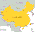
File:Greater China.GIF: Difference between revisions
Jump to navigation
Jump to search
Content deleted Content added
m (BOT): clean up of new upload |
Rosenzweig (talk | contribs) Tag: Manual revert |
||||||||||||||
| (19 intermediate revisions by 12 users not shown) | |||||||||||||||
| Line 1: | Line 1: | ||||||||||||||
{{update|date=October 2020|1=What happened in 1867 that justifies what this map says happened?}} |
|||||||||||||||
== {{int:filedesc}} == |
== {{int:filedesc}} == |
||||||||||||||
{{Information |
{{Information |
||||||||||||||
|Description=Map of Greater China |
|Description=Map of Greater China |
||||||||||||||
|Source={{own}} |
|Source={{own}} |
||||||||||||||
|Date={{ |
|Date={{original upload date|2007-11-28}} |
||||||||||||||
|Author={{user at project|Arab Hafez|wikipedia|en}} / Later version(s) were uploaded by [[:en:User:Cold Season|Cold Season]], [[:en:User:ILVTW|ILVTW]], [[:en:User:Pyl|Pyl]], [[:en:User:Gantuya eng|Gantuya eng]], [[:en:User:虞海|虞海]], [[:en:User:Yaan|Yaan]], [[:en:User:Historiographer|Historiographer]], {{user at project|Jjhcap99|wikipedia|en}}. |
|Author={{user at project|Arab Hafez|wikipedia|en}} / Later version(s) were uploaded by [[:en:User:Cold Season|Cold Season]], [[:en:User:ILVTW|ILVTW]], [[:en:User:Pyl|Pyl]], [[:en:User:Gantuya eng|Gantuya eng]], [[:en:User:虞海|虞海]], [[:en:User:Yaan|Yaan]], [[:en:User:Historiographer|Historiographer]], {{user at project|Jjhcap99|wikipedia|en}}. |
||||||||||||||
|Permission= |
|Permission= |
||||||||||||||
|other_versions= |
|other_versions= |
||||||||||||||
<gallery> |
|||||||||||||||
File:Đại Trung Hoa.gif|{{language|vi}} |
|||||||||||||||
</gallery> |
|||||||||||||||
}} |
}} |
||||||||||||||
{{Convert to SVG}} |
{{Convert to SVG|map}} |
||||||||||||||
{{update|date=January 2020|reason=In 1963, Pakistan ceded part of Kashmir to China. However, India still claims that territory and hence that territory needs to be colored the same way that Aksai Chin is colored. The area I'm referring to is a large strip of mountainous territory in southern Kashgar Prefecture. https://upload.wikimedia.org/wikipedia/commons/6/68/Kashmir_region_2004.jpg Also, the colorization of Mongolia and Siberia must be explained in the map key and the territorial claims of the Republic of China must be included.}} |
|||||||||||||||
== {{int:license-header}} == |
== {{int:license-header}} == |
||||||||||||||
| Line 31: | Line 36: | ||||||||||||||
[[Category:Maps of China]] |
[[Category:Maps of China]] |
||||||||||||||
[[Category:Greater China]] |
[[Category:Greater China]] |
||||||||||||||
[[Category:Files manipulated by sockpuppets of WorldCreaterFighter]] |
|||||||||||||||
| mediainfo | |||||||||||||||
|---|---|---|---|---|---|---|---|---|---|---|---|---|---|---|---|
| Property / copyright license | |||||||||||||||
| Property / copyright license: released into the public domain by the copyright holder / rank | |||||||||||||||
Normal rank | |||||||||||||||
| Property / copyright status | |||||||||||||||
| Property / copyright status: copyrighted, dedicated to the public domain by copyright holder / rank | |||||||||||||||
Normal rank | |||||||||||||||
| Property / inception | |||||||||||||||
28 November 2007
| |||||||||||||||
| Property / inception: 28 November 2007 / rank | |||||||||||||||
Normal rank | |||||||||||||||


