Döbling
Jump to navigation
Jump to search
Wien-Döbling
19. district of Vienna | |||||
| Upload media | |||||
| Pronunciation audio | |||||
|---|---|---|---|---|---|
| Instance of |
| ||||
| Location | Vienna, Austria | ||||
| Head of government |
| ||||
| Has part(s) |
| ||||
| Highest point | |||||
| Population |
| ||||
| Area |
| ||||
| Elevation above sea level |
| ||||
| official website | |||||
 | |||||
-
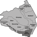
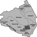
Map of Döbling
-
Map of Döbling, Oberdöbling highlighted
-
Wendls Casino, destroyed 1880
-
Sektkellerei Kattus
-
Parish church Döbling 1830
-
Parish church Döbling 2005
-
Monastary, Hofzeile
-
Gatterburggasse
-
Brewery Döbling about 1930
-
District office Döbling
-
Villa Wertheimstein
-
Wertheimstein Park
-
Gürtelbrücke Spittelau
-
Widmungsplakette Gürtelbrücke
-
Skywalk Spittelau
-
Skywalk Spittelau Guneschgasse
-
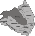
Map of Döbling, Grinzing highlighted
-
Grinzing with parish church
-
Parish church of Grinzing
-
Building in Cobenzlgasse
-
Parish church of Grinzing inside
-
Trummelhof
-
Old wine grower house in Grinzing/Cobenzlgasse
-
Grinzing Platz 1912
-
Grinzing seen from south abot 1900
-
Restaurant Cobenzl
-
Kaasgrabenkirche 1910
-
Kaasgrabenkapelle 1900
-
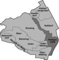
Map of Döbling, Heiligenstadt highlighted
-
Probusgasse 1898
-
Area of Karl-Marx-Hof/Trainstation
-
Pfarrplatz 1900
-
Pfarrplatz 2005
-
Map of Döbling, Kahlenbergerdorf highlighted
-
Kahlenbergerdorf
-
Map of Döbling, Josefsdorf highlighted
-
Map of Döbling, Salmannsdorf and Neustift am Wald highlighted
-
View over Neustift
-
Line of houses in the center of Neustift
-
Parish church of Neustift
-
Statue of Petrus
-
Statue of Paulus
-
Wine grower house
-
Map of Döbling, Nußdorf highlighted
-
Schreiberbach near Nußdorf
-
Map of Döbling, Salmannsdorf and Neustift am Wald highlighted
-
Small brook in the center of Salmannsdorf
-
Old farmhouse
-
Dreimarksteingasse (Center of Salmannsdorf)
-
Wine grower house
-
Old wine grower house
-
Chapel of Salmannsdorf
-
Inside the chapel
-
School Building Celtesgasse
-
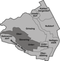
Map of Döbling, Sievering highlighted
-
Old part of Upper-Sievering
-
Parish church of Sievering
-
Parish church 1900
-
Sieveringer Straße/Fröschlgasse
-
Obersievering with Agnesgasse 1910
-
Obersievering with restaurant "Zur Agnes" 1910
-
Water reservoir Hackenberg, built in 1910
-
Map of Döbling, Unterdöbling highlighted
-
Rudolfinergasse 1910
-
Nußwaldgasse
-
Krim 1900
-
Karmeliterkirche
-
Heuriger in Rudolfinergasse (abgerissen)
-
Zacherl-Haus
-
Villa Hohe Warte, Front
-
Villa Hohe Warte, Architekturdetail
-
Restaurant Cobenzl on Reisenberg
-
St. Josephskirche on the Kahlenberg
-
Kahleberg (left) and Leopoldsberg
-
Leopoldskirche on the Leopoldsberg
-
Commemoration of Empress Elisabeth (Sissi) on the Leopoldskirche
-
Leopoldsberg
-
Leopoldskirche
-
Panoramic view on Vienna, as seen from Leopoldsberg
-
Sisi-Chapel
-
View from Hermannskogel over Döbling
-
Habsburgwarte on Hermannskogel
-
Badge on Habsburgwarte
-
Kahlenberg seen from Cobenzl
-
Latisberg seen from parking site Cobenzl
Historic maps
- Döbling und seine Umgebung in den Aufnahmeblättern der Franzisco-Josephinischen Landesaufnahme um 1872
-
Neustift, Salmannsdorf, Kahlenberg, Klosterneuburg
-
Kahlenbergerdorf, Heiligenstadt, Grinzing
-
Ober and Unter Döbling


