The state government of Andhra Pradesh has launched a website where residents can access the AP Cadastral map. We provide a comprehensive guide on how to find and download Andhra Pradesh’s cadastral maps for your reference.
Checking out the details of who owns what land in a given region of Andhra Pradesh is now much simpler for prospective buyers of real estate. Land maps may now be seen online thanks to an innovative effort taken by the government of Andhra Pradesh, which consisted of the rollout of the webpage known as BhuNaksha. This was seen as a significant step toward the prevention of property-related scams, which have been on the rise in the state.
On the BhuNaksha site, the details of the land will now be accessible to everyone who is a legitimate owner of the property. Using this website as a resource, residents may also view a digitised version of the land maps that is available to them.
See also: Bhunaksha Maharashtra : How to check land survey maps online in Maharashtra?
AP cadastral map: How to view and download AP land maps online on BhuNaksha?
Follow these steps to find and download land maps online for the different districts in Andhra Pradesh:
- Visit the official website for BhuNaksha Andhra Pradesh.
- The new window that will appear will directly guide you to search for the desired cadastral land map. Select the location for which you want a land map. To do so, you must choose the district, mandal, and village, as well as submit the survey number.
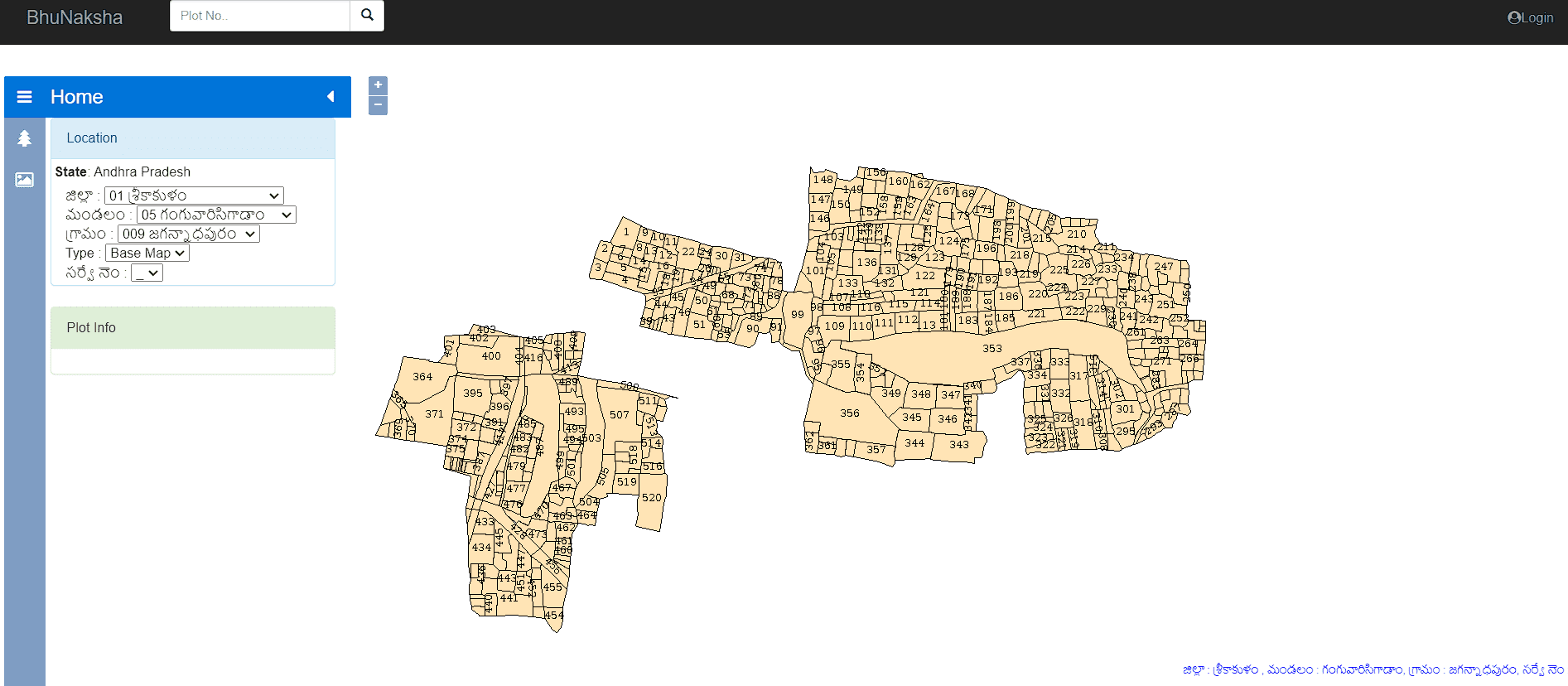
- On the right side of this portal, you will see the map of the surrounding area.
AP cadastral map: What is a field measurement book of a plot?
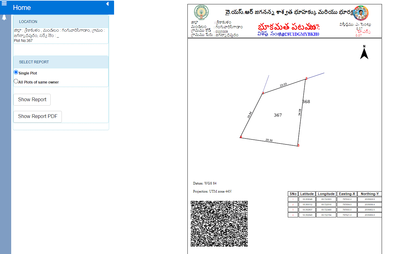
The Field Measurement Book (FMB) of land is a measurement book that is digitally signed and contains a more detailed map of a parcel. Andhra Pradesh residents can go online to view and save the FMB statistics.
Know about: Kurnool (Andhra Pradesh)
How to download FMB data online?
- Visit the official website for BhuNaksha Andhra Pradesh.
- Information like state, district, mandal, village, type, and survey number will need to be entered on the site.
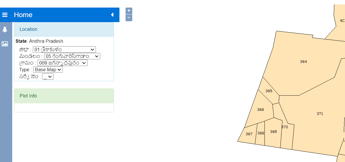
- Ensure that the Field Measurement Book is selected.
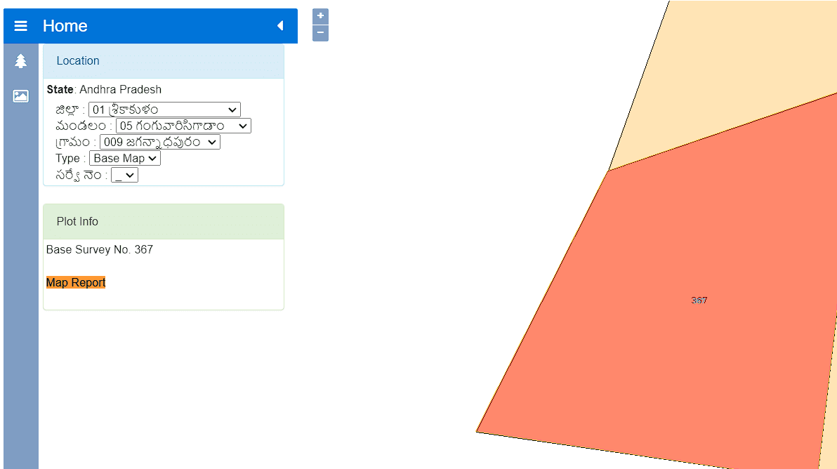
- Select the “View Report” button next to “FMB Print” to see the FMB information graphically.
AP cadastral map: How to access geo-referenced maps on BhuNaksha AP portal?
Click the tree symbol on the left side of the BhuNaksha page to get the geo-referenced map.
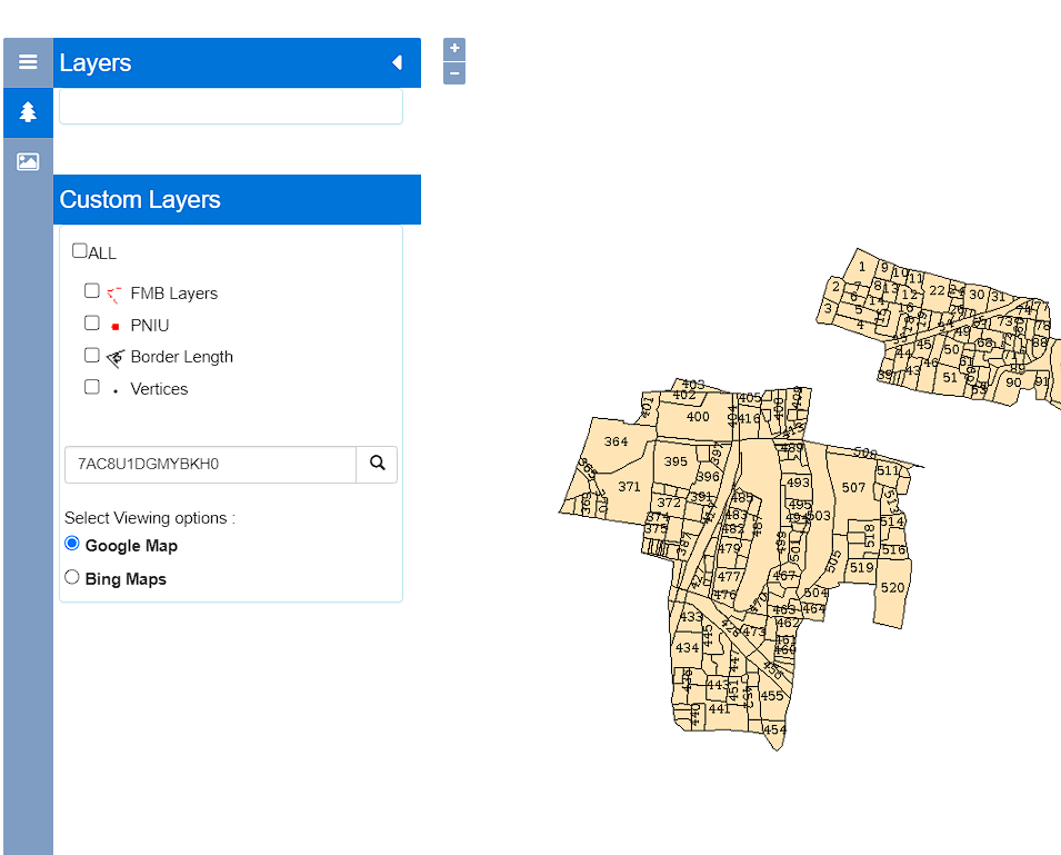
The YSRC administration has taken a groundbreaking step to streamline the land record transfer procedure by performing a thorough property resurvey. The decision was taken to guarantee honest leadership and a responsible government.
Know about: Nellore (Andhra Pradesh)
FAQs
Who designed the Andhra Pradesh BhuNaksha website?
The National Informatics Centre, Government of India, has built the BhuNaksha AP site in Andhra Pradesh for the state's citizens.
What is the primary function of the online BhuNaksha AP portal?
The site has been introduced to reduce property-related fraud and improve digital access to land maps for establishing ownership.
Can I print and download the online map?
Yes, all accessible land maps on the Bhunaksha AP site can be downloaded in PDF format and printed.


