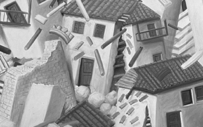
Photo Reflection: 1976 Earthquake in Guatemala
In the early morning hours of February 4, 1976, an earthquake that registered 7.5 on the Richter scale ripped through Guatemala. The quake left 23,000 dead, affected almost five million people, and caused damages in excess of one billion dollars. Over a million people – nearly one-sixth of the nation’s population – were left homeless. The quake centered on a fault line that cuts a latitudinal path through the country’s midsection. As the U.S. Geological Survey terms it, Guatemala is “earthquake country,” but the 1976 quake was the most destructive to hit the nation in nearly sixty years.
The earthquake was felt over a 38,000 square mile area. Transportation channels often follow the fault valley, which runs from just north of the capital city to the eastern coast. Miles of railroad tracks and asphalt were twisted and crumbled by the quake or buried by landslides. Food and water sources were severely limited and electricity and communication were cut off in many regions. A series of powerful aftershocks, including one that registered 6.0 in magnitude, added to the destruction and loss of life.
Cities and towns throughout the central highlands endured immense devastation. Several municipalities in the department of Chimaltenango were completely leveled. Antigua Guatemala, the former colonial capital known today for its spectacular architecture, also suffered the quake’s effects. Landmarks such as the Palacio de los capitanes generales – the seat of Spanish government for nearly two centuries – were heavily damaged.
The earthquake severely impacted Guatemala’s poorest inhabitants. Guatemala City residents who could afford to do so had constructed homes and offices that could withstand the region’s frequent rumbles. Many of the urban poor, on the other hand, were left homeless, or worse, buried beneath the rubble. Rapid urbanization had created a severe housing deficit in the capital city. Squatter settlements had sprung up on mountainsides around the city’s perimeter. These adobe houses, perched uneasily on rocky inclines, offered no protection from the quake or the fires that engulfed much of the city in its aftermath. Many settlements were entirely destroyed.
Winter 2007, Volume VI, Number 2
Kedron Thomas is a Ph.D. candidate in the Department of Anthropology at Harvard University. Her research is on indigenous entrepreneurship and the effects of free trade policy in highland Guatemala.
Related Articles
Editor’s Letter: Natural Disasters
We were little black cats with white whiskers and long tails. One musical number from my one and only dance performance—in the fifth grade—has always stuck in my head. It was called “Hernando’s Hideaway,” a rhythm I was told was a tango from a faraway place called Argentina.
After the Earthquake: Juan’s Life
Juan was a construction helper. He lived in Armenia, but his parents were from the Antioquia region, who had fled because of the violence there. The mother of his children was called…
Political Memory
Late in 1717 Dr. Joseph Surin, precentor of the Cathedral of Old Guatemala, carried out some calculations: had the mudslide that wiped the city on the 28th of August, feast day of Saint…


