Texas Natural Resources Chapter 1 Section 2 Viewing


- Slides: 25

Texas’ Natural Resources Chapter 1 Section 2

Viewing Texas • The southernmost point in Texas meets the Gulf of Mexico; Padre Island Laguna Madre lie along the southern Gulf coast. • North of Brownsville the land rises slowly and is covered with cactus, Mesquite trees, and other hot-climate plants. • The Balcones Escarpment follows a fault that cuts across Texas in an arc.

Padre Island – Southernmost Point No Waves Barrier Island Waves

South Texas – Rio Grande Valley

South Texas Brush Country

Balcones Escarpment

Viewing Texas • The Hill Country is a plateau that begins at the Balcones Escarpment and Contains more streams and rivers than any other part of Texas. • The Caprock Escarpment disrupts the high plains of northwest Texas and Creates beautiful canyons, such as Palo Duro and Tule Canyons. • From the plains of West Texas rise numerous mountain ranges.

Texas Hill Country

Central Texas

Central Texas

Caprock Escarpment - Lubbock

West Texas Mountains

West Texas

West Texas

West Texas

Texas Water Resources • Increasing demands for water are straining the ecosystems of communities along rivers and near dams in Texas. • The Gulf of Mexico and bays along the Texas coast are the state’s main water resources. • Because rivers polluted by waste and chemicals empty into these bays, seafood from them is sometimes declared unsafe to eat.

The “Wrong-Way” Rivers of Texas (pages 33– 34) • Although the Rio Grande is the state’s largest river, it carries little water compared to other rivers of its length. • Other Texas rivers include the Panhandle’s Red River and Canadian River and East Texas’s Sabine, Neches, Trinity, San Jacinto, Brazos, Colorado, and Pecos Rivers.

Rio Grande River

Red River

Canadian River

Sabine River – East Texas

Neches River - Beaumont

Lake Buchanan Dam – Central TX

The “Wrong-Way” Rivers of Texas (pages 33– 34) • Texas’s rivers flow away from the dry northwestern region, where water is most needed, to the moist southeast, and are thus called “wrong-way” rivers. • Many Texas rivers are dammed to control floods and to help keep precious water from flowing unchecked into the Gulf of Mexico.

Texas Lakes Have Many Uses (page 34) • All but one of the major lakes of Texas, Caddo Lake in East Texas, was created by damming rivers. • Once created to control floods and provide irrigation, Texas lakes now provide most of the water needed for cities and manufacturing.
 Chapter 4 landforms water and natural resources
 Chapter 24 the land where continents collided
 Chapter 21 section 1 landforms and resources
 Landforms and resources section 1
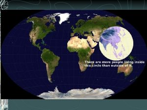
 China population density
 Chapter 11 section 1 water resources
 Chapter 18 section 1 landforms and resources
 Unit 2 the united states and canada worksheet answers
 Transformation process in operations management
 Fixed resources
 Renewable vs nonrenewable resources worksheet
 Claim of value acrostic poem
 Example of full section
 Film as text
 Eccentric viewing techniques occupational therapy
 For viewing tiny objects in a microscope, diffraction is
 Thank you for viewing my presentation
 Steps in viewing
 Contoh viewing 3d
 The viewing pipeline
 Viewing coordinate sering juga disebut
 Even though the banana seemed to change color
 Viewing pipeline
 Types of projection in computer graphics
 3d viewing devices in computer graphics ppt
 In two dimensional viewing system have
