Before logging this EarthCache as "found," please e-mail me the answers to the following questions:
- Was the flood level at this location on September 16, 1999 above your head?
- Give at least two benefits that flood plains provide?
- Give at least two factors that contribute to flooding?
- What river does the Toisnot Swamp eventually flow into? (You may need to look at a map.)
- Can one location have a 100-year flood two years in a row?
- What are the odds of having a 100-year flood any given year?
- Bonus Question - What is the percent chance of having a 500-year flood any given year?
Photos are appreciated.

The coordinates take you to a parking area beside the Toisnot Reservoir. This area, as well as others through Wilson and Eastern NC, saw major flooding in September 1999. If you look around, you should see a sign that shows the flood level during Hurricane Floyd. Find this and you will have the answer to your first question. This area is also a popular park with walking trails, sports fields and playgrounds. The Toisnot Swamp is where the earliest settlers inhabited the area. This area, along with Contentnea Creek, are the primary waterways in Wilson as there are no rivers. This reservoir is the site of the first water plant in Wilson, created in 1890.
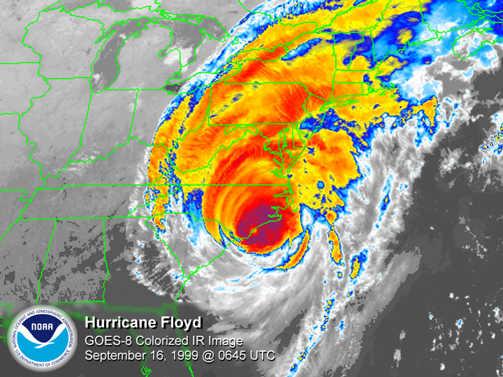
If you are from the area, you probably remember Hurricane Floyd well. Virtually every road east of Interstate 95 was flooded as the area received 15-20 inches of rain. This, just weeks after Hurricane Dennis soaked the area with 5-7 inches of rain. Nearly every river basin in Eastern NC exceeded 500-year flood levels. The nearby Tar River (Nash County) crested at a record 35 feet, more than 10 feet higher than the previous record. The estimated damage from Hurricane Floyd approached $7 billion, $3 billion of that was in NC. In NC, 7,000 homes were destroyed, 56,000 homes were damaged, 1,500 people were rescued from flooded areas, and 35 people lost their life.
 Although Hurricanes have caused several floods in NC, floods are more frequently in the form of flash floods from thunderstorms. With no rivers or large bodies of water in Wilson County, and the relatively flat topography, storm runoff can be slow. Flash floods move quickly and can roll boulders, uproot trees and destroy buildings and bridges.
Flood plains are actually beneficial. These benefits include assisting with storm water runoff, minimizing pollution, reducing the severity of floods, and aesthetics. Many flooded areas after Hurricane Floyd were turned into parks. Floods also carry nutrient-rich sediments which help with vegetation. The wetlands within these floodplains filter flood waters and help the overall ecosystem. Many factors can contribute to excessive flooding. Some of these are dumping, sedimentation, debris and vegetation growth.
What IS a 100-year flood? Does this mean a flood that only happens once every 100 years? Not exactly. A better term would be a 100-year recurrence interval. This means that the probability of a flood of that magnitude is once in 100 years, or a 1 percent chance of happening in any given year.
| I have earned GSA's highest level: |
 |