near to Sherburn in Elmet, North Yorkshire, England
- We have 26 images for SE4834
- See geographical distribution of pictures
- View on Coverage Map
- View all images: slideshow, thumbnails
- Submit your own picture
- login to start a discussion about SE4834
- View images by D-Block
- Geograph Coverage Map, Photo Mosaic
- Nearby Tags - Nearby Collectionsnew
Loading map... (JavaScript required)
Sample images
Breakdown list
A sample of 12 photos from 26
for SE4834
- View this square in the Browser >>>
or

|
Railway bridge over Coldhill Lane
by John Slater
|

|
The Leeds - York railway line, north of Coldhill Lane
Embanked to cross the valley of Stream Dike.
|

|
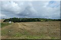
Farmland near Sherburn in Elmet |

|
Farmland from railway near Mile Hill
by John Firth
|

|
Drainage ditch off Coldhill Lane
by JThomas
|
|
Field near Copley Lane Quarry
by DS Pugh
Looking across farmland at Mile Hill.
|

|
Footpath heading South towards Hall Garth
by Chris Heaton
The footpath has disappeared under the weight of lush vegetation
|

|
Stream Farm, Sherburn in Elmet |

|
From a Leeds-York train, countryside near Sherburn-in-Elmet |

|
Stream Farm, Sherburn in Elmet
Recreating this 'First' for the square Link
|

|
Access track to Copley Lane Quarry
The site is used by Associated Waste Management Ltd, who applied for planning permission for a recycling plant here in 2013.
|

|
Farmland, Mile Hill
by JThomas
|
Explore more images in this square: | View Filtering options | View all 26 images page by page >>> |
|