Grid reference ST6472
near to Hanham, South Gloucestershire, England
Coverage
We have
66 images
in grid square ST6472
Contribute
Explore gridsquare ST6472
Surrounding area
Maps
TIP: Click the map for more Large scale mapping
Tip: Click the map to open the coverage map
Sample images
Breakdown list
A sample of 12 photos from 66
for ST6472
- View this square in the Browser >>>
|
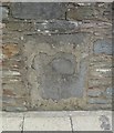
Old Milestone by High Street, Hanham, Bristol
by M Faherty
Carved stone post by the A431, in parish of HANHAM ABBOTS (SOUTH GLOUCESTERSHIRE District), High Street, by junction with Tabernacle Road, inset into boundary wall of No. 17a, on East side of road. Erected by the Bristol turnpike trust in... (more)
|
|
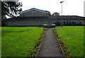
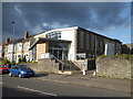
War memorial garden in Hanham
by Bill Boaden
The frontage for the community centre.
|
|
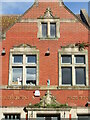
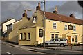
Growing on The Jolly Sailor
by Neil Owen
Part of the brick frontage of the pub, with some carved masonry and opportunist plants.
|
|
Hanham Mount, Mount Hill Road
by Chris Allen
A display board here points out the links with evangelical preachers who had preached here.
|
|
Hanham Methodist Church |
|
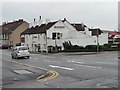
The Blue Bowl, Hanham
At the junction of High Street and Whittucks Road.
|
|
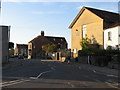
Kingswood : The Queen's Head
by Lewis Clarke
The Queen's Head on Lower Hanham Road in Kingswood.
|
|
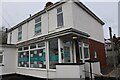
Hanham : Baker Street Nursery
by Lewis Clarke
A nursery on Creswicke Avenue.
|
|
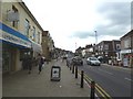
Hanham High Street
by Mike Faherty
With a good mixture of small businesses.
|
|
Hanham Baptist Church
by Chris Allen
|
|
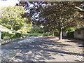
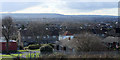
2011 : View from Mount Hill Road, Hanham
Most of Hanham is built on slopes from the River Avon up to Kingswood.
There are occasional views of south east Bristol. This is over Brislington and Stockwood with Dundry Hill in the background. In the original version it is possible to... (more)
|
|
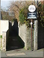
No horses, no bikes
by Neil Owen
The old lane on Lower Hanham Road is not big enough for that sort of thing. Horses (presumably from the time when this area was very much rural) and bicycles are specifically banned. Horses riding bikes especially so.
|
Explore more images in this square: | View Filtering options | View all 66 images page by page >>> |
|