2010
NS4177 : The edge of Barr Wood
taken 14 years ago, near to Bellsmyre, West Dunbartonshire, Scotland
This is 1 of 2 images, with title The edge of Barr Wood in this square
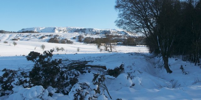
The edge of Barr Wood
The core path leads along the north-eastern edge of Barr Wood (shown here) towards the photographer's position. The ditch that follows the edge of the woods is the course of a burn; a later picture, without snow, shows it: NS4177 : The edge of Barr Wood.
The escarpment of the Kilpatrick Hills is visible in the background (NS4376). More clearly visible in larger versions of the image is a building in front of the right-hand edge of the escarpment; this is part of Maryland Farm, and the building to its left, obscured by trees, is NS4177 : Priestyard.
Previous: NS4176 : Track to Maryland Farm.
Next: NS4177 : Moorland fence.
From Garshake Road to Square Wood :: NS4176
This route is one of West Dunbartonshire's core paths. It starts at the top of Garshake Road. Note that only pictures taken from mid-2014 onward accurately reflect the current situation near Maryland Farm, showing the paths for walkers that were built there when the land became part of Lang Craigs Woodland; earlier pictures show, instead, an improvised but (at that time) officially approved route that served until then, and which led around the margins of a field.
TIP: Click the map for more Large scale mapping
- Grid Square
- NS4177, 75 images (more nearby 🔍)
- Photographer
- Lairich Rig (more nearby)
- Date Taken
- Thursday, 2 December, 2010 (more nearby)
- Submitted
- Wednesday, 22 December, 2010
- Subject Location
-
OSGB36:
 NS 4156 7728 [10m precision]
WGS84: 55:57.7390N 4:32.3854W - Camera Location
-
OSGB36: NS 4152 7731
- View Direction
- Southeast (about 135 degrees)