2006

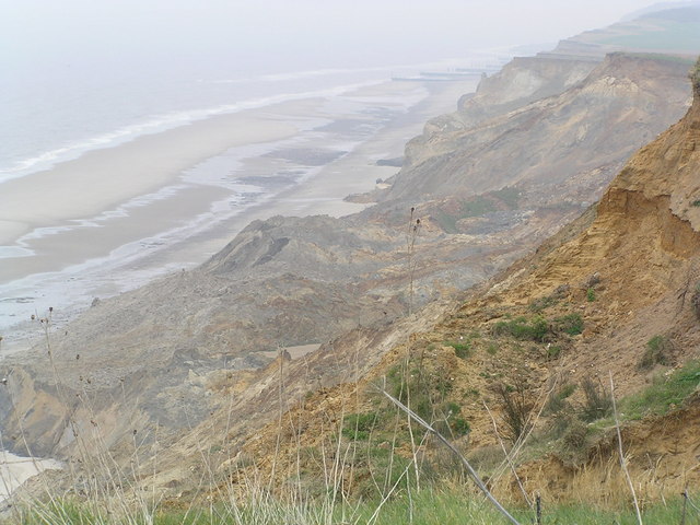
TG2639 : Recent cliff fall, Sidestrand

taken 19 years ago, near to Sidestrand, Norfolk, England
Recent cliff  fall, Sidestrand
Recent cliff fall, Sidestrand
A recent cliff fall shows typical slumping which happens regularly on this unprotected section of coastline. A pool of water can be seen trapped in the debris. Material from this section of coast gets transported both NW and SE and helps build up the coast at Blakeney and Yarmouth

Creative Commons Licence [Some Rights Reserved]   © Copyright Helen Hanley and licensed for reuse under this Creative Commons Licence.
Category: Coastline/Beaches
1:50,000 Modern Day Landranger(TM) Map © Crown Copyright
+
+
1:50,000 Modern Day Landranger(TM) Map © Crown Copyright
TIP: Click the map for more Large scale mapping
Grid Square
TG2639, 122 images   (more nearby 🔍)
Photographer
Helen Hanley   (more nearby)
Date Taken
Saturday, 15 April, 2006   (more nearby)
Submitted
Monday, 13 November, 2006
Subject Location
OSGB36: geotagged! TG 263 399 [100m precision]
WGS84: 52:54.5501N 1:21.9102E
Camera Location
OSGB36: geotagged! TG 260 399
View Direction
EAST (about 90 degrees)
Clickable map
+
NW N NE
W Go E
SW S SE
Image classification(about): Geograph (Second Visitor for TG2639)
This page has been viewed about 245 times
You are not logged in login | register