Flooding
Traditional flood monitoring
In the field of traditional flood monitoring, two classic methods are mainly relied upon. One is to set up water gauges on the banks of water bodies or on hydraulic structures. Observers take manual readings at specific times every day, such as 8:00 and 20:00, and even more frequently during the flood season, to determine the water level. This method is simple to operate and the readings are intuitive. However, it inevitably has errors caused by manual readings and is highly vulnerable to interference from the observation environment, such as bad weather and poor lighting. At the same time, it cannot achieve real-time monitoring of the dynamic changes of the water level, nor can it collect water quality information.

small and medium-sized rivers

lakes and reservoirs
The second method is to measure the flow velocity by placing buoys on the river surface. Usually, a river section with stable water flow and a straight river channel is selected. The fixed distance is measured in advance. After the buoy is placed, the time it takes for the buoy to pass through this distance is accurately recorded, and then the buoy flow velocity is calculated. The average flow velocity of the river channel is then estimated based on empirical relationships. However, in actual operation, factors such as the magnitude of the wind and differences in buoy types can significantly affect the measurement accuracy. Similar to the water gauge monitoring method, it is difficult to effectively monitor the water quality.
How to improve?
To address issues such as the lag and poor accuracy of traditional monitoring, we have introduced Kacise ultrasonic water level gauges, radar water level gauges, and water quality sensors to conduct real – time monitoring of the liquid levels and water quality of rivers, lakes, and reservoirs.
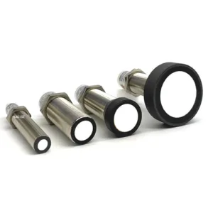
Ultrasonic Water level Gauge:
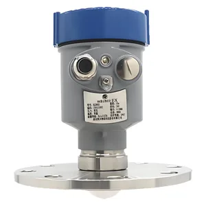
The ultrasonic water level gauge operates based on the characteristics of ultrasonic wave propagation in the air. It emits ultrasonic pulses towards the water surface. After the pulses are reflected by the water surface, they are received by the sensor. By combining the time difference between emission and reception with the propagation speed of ultrasonic waves, the distance from the sensor to the water surface can be accurately calculated, and then the water level height can be obtained.
This water level gauge is not affected by the electrical conductivity and corrosiveness of water, has excellent stability, and can operate stably for a long time. It supports solar panel power supply, can effectively utilize clean energy, and can operate normally even in remote areas without mains power. Moreover, it can be equipped with a wireless data collector to achieve real – time transmission of water level data to a remote monitoring center or related platforms through wireless signals. Whether it is in remote water areas or urban drainage systems, staff can remotely obtain water level information, providing accurate data support for flood control, irrigation, shipping, and other work.

Radar Water level Gauge:
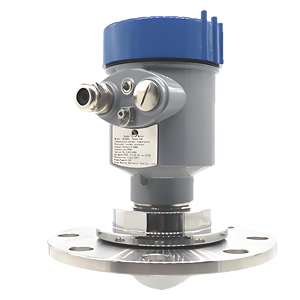
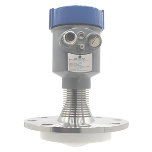
The principle of the radar water level gauge is similar to that of the ultrasonic water level gauge. It measures the water level by transmitting and receiving electromagnetic waves. The electromagnetic waves it emits are reflected when they encounter the water surface, and the water level is calculated based on the propagation time and speed.
This water level gauge has high accuracy and a large measurement range, is not affected by weather and water quality, and can adapt to complex environments. It supports solar panel power supply, can effectively utilize clean energy, and can operate normally even in remote areas without mains power. Moreover, it can be equipped with a wireless data collector to achieve real – time transmission of water level data to a remote monitoring center or related platforms through wireless signals. In the fields of water conservancy projects and ocean monitoring, relevant personnel can remotely and real – time obtain water level data, providing strong support for project scheduling and decision – making.
Water Quality Sensor:
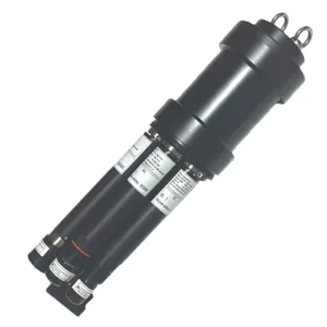
The water quality sensor is very powerful and can monitor water quality changes in real – time. It can monitor pollutant concentrations, providing a basis for the prevention and control of flood – related pollution, and can also track water quality changes, helping with subsequent restoration and reconstruction. In terms of ensuring drinking water safety, it closely monitors the water quality of water sources, promptly warns of abnormalities, and detects emergency water supply indicators to prevent the spread of diseases. At the same time, it can assess the impact on the ecological environment, warn of water eutrophication, and assist in flood – control decision – making.
This sensor supports solar panel power supply, operates stably, and reduces wiring costs and maintenance difficulties. It can be equipped with a wireless data collector, which can quickly transmit water quality data to the management system, facilitating environmental protection and water conservancy departments to promptly understand the water quality situation and take effective governance and protection measures.

Cases

Flood Disaster Early Warning

Urban Drainage System Management

Water Quality Monitoring After Floods
