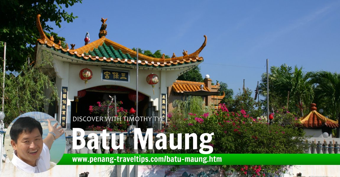
 Batu Maung (10 June 2006)
Hok1kien3 Yak1
Batu Maung (GPS: 5.28491, 100.2875; Traditional/Simplified Chinese: 峇都矛; Pinyin: Bādōu Máo; Penang Hokkien: Ba3tu1 Mau2) is a small fishing village on the southeast tip of Penang Island. The Penang Island end of the Second Penang Bridge is located here. Until the arrival of the bridge, Batu Maung is just a small, quiet fishing village with a rocky promontory.
I grew up in Batu Maung, albeit a very different Batu Maung from what it is today. I remember it as a small village where my father used to take me to to buy fish directly from the fishermen as their boats arrived at shore. Our house is on a hill where I suffered a lot of mosquito bites when I was growing up.
 Discover with Timothy Videos
 Map of Batu Maung
Sights in Batu Maung in alphabetical order
Amenities in Batu Maung
- Batu Maung Post Office (GPS: 5.28534, 100.28624)

 Apartments and Condominiums in Batu Maung
- Desa Jelita (GPS: 5.2779, 100.27263)

- Desa Kayu Manis (GPS: 5.27722, 100.2739)

- Desa Wangsa (GPS: 5.27787, 100.27098)

- Southbay Plaza (GPS: 5.28475, 100.28888)

- The Loft (GPS: 5.28197, 100.28785)

 Businesses in Batu Maung
- 7-Eleven
- BB Futsal (indoor football arena)
- Indian Barber Shop
- Kim San Mini Market
- LL Challenger Motor (motorcycle dealer)
- LSS Green Innovation Lifestyle Concept (lighting)
- Lye Biaw Motor (motorcycle repair)
- OCBC Bank
- Pheng Motors (motorcycle repair & dealer)
- Siew Eng Motor (auto service)
- Sonic Motor Enterprise (motorcycle repair & dealer)
- OCBC Bank - Batu Maung Branch
- OK Auto Mart
- Orion Car Accessories Auto Mart
- Yew Tat Hardware & Electrical Supplies
 Chinese Temples in Batu Maung
- Batu Maung Bottle Temple (GPS: 5.2809, 100.28529)

- Cheng Chooi Keong Temple (formerly Chor Soo Kong Temple) (GPS: 5.28118, 100.28636)

- Sam Poh Footprint Temple (GPS: 5.28505, 100.29078)

 Coffee Shops in Batu Maung
- 1178 Food Corner
- Astaka Batu Maung (GPS: 5.29554, 100.28011)

- Batu Maung Jalan Baru Food Court
- Chai Seafood
- Kedai Kopi dan Makanan Bond Bond (GPS: 5.29571, 100.28022)

- NSN Kopitiam
- Restoran Lye
- Restoran Nasi Kandar Dinas
- Restoran Pen Mutiara
- Xin Yuen Cafe
 Hindu Temples in Batu Maung
 Housing Estates in Batu Maung
- Desa Batu Maung (GPS: 5.28349, 100.28614)

- Legenda @ Southbay (GPS: 5.27936, 100.28623)

- My Sakura 28 (GPS: 5.29319, 100.25668)

- Residence @ Southbay (GPS: 5.27961, 100.28651)

- Sunway Cassia (GPS: 5.27742, 100.2741)

- Sunway Mutiara (GPS: 5.28007, 100.28149)

- Sunway Tunas Jaya (GPS: 5.28001, 100.27471)

- Taman Iping (GPS: 5.28729, 100.28323)

- Taman Sri Mewah Indah (GPS: 5.28359, 100.27771)

Industrial Parks in Batu Maung
 Markets in Batu Maung
- Pasar Batu Maung (GPS: 5.29546, 100.2803)

 Mosques in Batu Maung
- Masjid Jamek Batu Maung (GPS: 5.28125, 100.28372)

Neighbourhoods of Batu Maung
 Petrol Stations in Batu Maung
- Caltex Kampung Binjai (GPS: 5.28294, 100.25718)

Private clinics in Batu Maung
Roads in Batu Maung
- Gerbang Batu Maung 1
- Jalan Baru Batu Maung
- Jalan Batu Maung
- Jalan Jeliti
- Jalan Permatang Damar Laut
- Lebuh Batu Maung 1
- Lebuh Batu Maung 1/2
- Lebuh Batu Maung 1/3
- Lebuh Batu Maung 2
- Lebuh Batu Maung 3
- Lebuh Batu Maung 4
- Lebuh Batu Maung 6
- Lebuh Batu Maung 7
- Lebuh Batu Maung 8
- Lebuh Batu Maung 9
- Lebuh Batu Maung 10
- Lebuh Batu Maung 11
- Lebuh Batu Maung 12
- Lebuh Batu Maung 12/1
- Lebuh Batu Maung 13
- Lebuh Batu Maung 17
- Lebuhraya Batu Maung
- Lengkok Batu Maung
- Lengkok Batu Maung 1
- Lilitan Batu Maung
- Lintang Batu Maung
- Lintang Batu Maung 1
- Lintang Batu Maung 2
- Lintang Batu Maung 3
- Lintang Batu Maung 4
- Lorong Batu Maung 2
- Lorong Batu Maung 3
- Lorong Batu Maung 4
- Lorong Batu Maung 6
- Lorong Jeliti 1
- Solok Batu Maung
 Schools in Batu Maung
- Sekolah Jenis Kebangsaan (Cina) Wen Khai (GPS: 5.29475, 100.28033)

- Sekolah Kebangsaan Batu Maung (GPS: 5.28202, 100.28337)

- Sekolah Menengah Kebangsaan Batu Maung (GPS: 5.28276, 100.28571)

 Sights in Batu Maung
- Batu Maung 8 Batu Neighbourhood Park (GPS: 5.28567, 100.27779)

- Goalkick Futsal Arena (GPS: 5.29573, 100.28058)

- Penang Aquarium (GPS: 5.28587, 100.28626)

- Penang War Museum (GPS: 5.28142, 100.28872)

- Puspakom Batu Maung (GPS: 5.28258, 100.27058)

- Second Penang Bridge (GPS: 5.29198, 100.29356)

- Stesen Pengurusan Sisa Pepejal Batu Maung (GPS: 5.29169, 100.29283)

- Taman Iping Neighbourhood Park (GPS: 5.28572, 100.2804)

Location of Batu Maung
Measured from the Batu Maung Roundabout (GPS: 5.285066, 100.287680), Batu Maung is 16.0 km to Komtar, 9.5 km to the Penang Bridge, 1.3 km to the Second Penang Bridge and 7.9 km to the Penang International Airport.About Batu Maung
Within Batu Maung are several small villages including the Batu Maung village (called Pekan), Kampung Seronok, Kampung Binjai, Permatang Damar Laut, Teluk Tempoyak and Jalan Baru.Today Batu Maung is very different from what I remember it. The site where my house was located is now a big housing estate. Double-storey link houses fill the land that was once holding just our house and a huge compound. More development is expected to take place in Batu Maung, now that the Second Penang Bridge will be built here.
The two main roads in Batu Maung, namely Jalan Batu Maung and Jalan Permatang Damar Laut, are also seeing rapid changes. Jalan Batu Maung, in particular, has become an industrial main road, lined with warehouses of freight companies. Jalan Permatang Damar Laut, once a windy rural road, is being developed with housing estates.
Batu Maung is where the deep sea fishing port is located. It is not surprising therefore that Batu Maung is famous for seafood. In the sixties and early seventies, there was a famous seafood restaurant here called Ocean Inn. Ocean Inn as a Penang version of Har Par Villa, with its cement statues of Chinese mythology.
By the eighties and nineties, Ocean Inn has been replaced by newer seafood establishments. There was one called "Beginning of the World", named after the tip of the promontory known as the Beginning of the World, at the southernmost part of Batu Maung. The restaurant used to be located in the middle of the sea, and accessible by a plankway. It has since moved inland to the Batu Maung village centre, near the crossroads.
Batu Maung is also famous for having a temple dedicated to Admiral Cheng Ho (Zhenghe). The Sam Poh Footprint Temple, which initially was just an altar built over a rock right at the shoreline, has since been developed into a proper temple. It enshrines what appears to be a giant footprint - the footprint of Sam Poh, the local name given to Cheng Ho.
In the hills above Batu Maung are war relics from the Second World War. These were built by the British who had expected the Japanese to invade from the sea, and had stationed the arms southwards. As it happened, the Japanese invaded from the north, ande the artileries were unused. Today the war relics are now part of the Penang War Museum.
The Malaysian Fisheries Research Institute occupies a piece of land in Batu Maung. This is where the Penang Aquarium is located. It showcases a small collection of marine life. Next door to it is the WorldFish Centre, a Unesco-funded research institute which operates in Batu Maung after moving from the Philippines in 2000.
A great part of Batu Maung consisted of mangrove swamp. In the recent decade, the mangrove had been cleared - to the chagrin of environmentalists, as it caused a loss of habitat for the wildlife such as the birds and monkeys. The land was reclaimed to form Phase 4 of the Bayan Lepas Industrial Zone.
As Batu Maung is located at the southernmost end of the Tun Dr Lim Chong Eu Expressway, it has become a choice site for property development. Several new housing estates have sprouted here. Development of Batu Maung is expected to further accelerate now that it has been identified as the end-point of the second bridge to link Penang island to Batu Kawan on the mainland.
Getting to Batu Maung by public transport
Batu Maung is served by Rapid Penang bus 302, 305 and 307.Sam Poh Footprint Temple
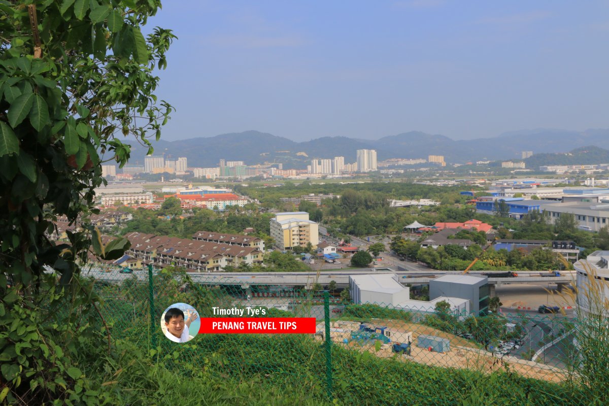
 Batu Maung, with the new Jalan Permatang Damar Laut viaduct in the foreground, and high-rises of Sungai Ara in the distance. (7 February 2018)
 Batu Maung, Penang, as seen from the Second Penang Bridge construction site (20 October 2012)
 Businesses in Batu Maung (15 September 2012)
 Fishing boats in Batu Maung (10 June 2006)
List of Towns in Penang and Towns in Malaysia
Private Guided Tours of Penang
If you are seeking private guided tours of Penang, message Penang Tour Guides at [email protected] and enquire with them. Buy, rent or sell properties in Penang
Do you have a property for sale or to rent out? Are you looking to buy or rent a property? Get in touch with me. WhatsApp me (Timothy Tye) at 012 429 9844, and I will assign one of my property agents to serve you. I will choose the agent for you, according to your property needs. So when you message me, provide me some details of what you need, whether to sell, to buy, to rent or to rent out, and what type of property, is it condo, apartment, house, shop, office or land. Latest updates on Penang Travel Tips
 Map of Roads in Penang
Looking for information on Penang? Use this Map of Roads in Penang to zoom in on information about Penang, brought to you road by road.About this website

Dear visitor, thank you so much for reading this page. My name is Timothy Tye and my hobby is to find out about places, write about them and share the information with you on this website. I have been writing this site since 5 January 2003. Originally (from 2003 until 2009, the site was called AsiaExplorers. I changed the name to Penang Travel Tips in 2009, even though I describe more than just Penang but everywhere I go (I often need to tell people that "Penang Travel Tips" is not just information about Penang, but information written in Penang), especially places in Malaysia and Singapore, and in all the years since 2003, I have described over 20,000 places.
While I try my best to provide you information as accurate as I can get it to be, I do apologize for any errors and for outdated information which I am unaware. Nevertheless, I hope that what I have described here will be useful to you.
Copyright © 2003-2025 Timothy Tye. All Rights Reserved.


 Go Back