Vintage Map Of The WorldDifferent CitiesWorld Map WallpaperAntique World MapPosters For RoomWhatsapp WallpaperMap Of The WorldCountries In The WorldWorld Map Poster7 Places I Want To Visit SomedayI have a problem with wanting to travel to too many different cities and countries in the world.4.1k
World Map TemplateWorld Map PhotoWorld BackgroundMap PhotoMap TemplateWorld Map DesignIdee CricutCool WorldThe World MapHow To Make A Cool World Map Denim Floor CushionTurn your old denim into a delightful world map floor cushion with our DIY guide. An upcycle to add a touch of worldliness to your home.1.5k
Diy Faux Brick WallFaux Brick WallMap LogoWorld Map PaintingBrick Accent WallSuper PicturesFaux Brick PanelsWorld Map Wall DecalIdee CricutDIY Faux Brick Wall {Indoor Accent Wall} - Classy ClutterGetting a beautiful brick accent wall is easier than you think. Check out this DIY Faux Brick Wall project. Our brick wall even has a world map painted on it. So much fun!1.9k
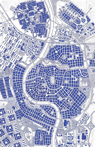
European Urban PlanningOrganic Urban DesignFictional City MapMap Graphic Design IllustrationRome Graphic DesignEuropean Graphic DesignSimple Map DesignGraphic Design MapMaps Graphic DesignCity map ++Hand drawn city map of Raalte (called after some Dutch town). The city is situated on two rivers, on of them being an affluent, ending in the other. It's drawn as a city as it could have grown in multiple centuries: city center, former bastions, station close to the river side, apparment buildings from the 70s and newer neighbourhoods surrounding the city. In a word: a very European city. Why it is called Raalte? Well, I just like place names ending on -e and after having made up twenty of…18.1k
Indian River MapFull World MapMap Of ContinentsFree Printable World MapIndia World MapWorld Map PictureWorld Geography MapPrintable World MapWorld Map PhotoWorld Maps, Geography, and Travel InformationExplore world maps, geographic insights, and travel information. Find accurate data for countries, continents, and cities. Start your journey now!36
Vintage Map DrawingOld Map IllustrationOld Fantasy MapFantasy World Map DesignOld Map DrawingOld World Maps VintageOld Map AestheticOld Treasure MapOld Maps VintagePremium Vector | Old map, vector worn parchment with caribbean and southern sea, ships, islands and landDownload this Premium Vector about Old map, vector worn parchment with caribbean and southern sea, ships, islands and land, and discover more than 15 Million Professional Graphic Resources on Freepik70
Global Map WallpaperThe Map Of The WorldWorld Map With Names Of CountriesWorld Map With Country Names HdFree Printable World Map With CountriesWorld KnowledgeMap Of The World PrintableWorld Map With Country NamesPrintable World Map With CountriesWorld Map with Countries - General Knowledge for Kids | MocomiWorld Map of Countries - Download this printable maps of all the countries of the world along with countries name. For more interacting General knowledge for kids, visit: http://mocomi.com/learn/general-knowledge/3.5k
World Map Blank PrintableThe Map Of The WorldBlank World Map With CountriesBlank Map Of The WorldBlank World Map Printable FreeFree Printable World Map With CountriesMap Of The World AestheticVision Board PsychologyMap Of The World PrintableBlank World Maps - 10 Free PDF Printables | PrintableeBlank World world maps printable are great for educational purposes, allowing you to test your geography knowledge or plan your next adventure..890
Dessin Game Of ThronesGame Of Thrones MapWesteros MapGot MapFantasy Map MakingFantasy World MapMap GamesMap IdeasMap MakingThe essential Game Of Thrones maps to bookmark right nowYour vital visual guide to Westeros and beyond5.4k
Maps AestheticCollage Muralطابع بريديQuilt BackingQuilt FabricsPicture Collage WallMap WallpaperQuilting FabricsAntique MapsQuilt fabric, Largest selection of quilting fabrics- Free Quilt PatternseQuilter is the world's favorite Quilt Fabric store for quilting, sewing and fabric lovers. Free Shipping on orders $100 or more!5k
Pirate MapMap InspirationPirate Treasure MapsInktober 2023Map PostersJungle CruiseMap PatternPirate FashionWorld GlobesPremium Vector | Paper with pirate treasure map in vintage styleDownload this Premium Vector about Paper with pirate treasure map in vintage style, and discover more than 15 Million Professional Graphic Resources on Freepik1.5k
Aesthetic Map DrawingVintage Map AestheticArte MadiCompass ArtMaps AestheticPhone Wallpapers VintageWhatsapp Wallpapers HdWallpaper TravelSimplistic WallpaperAesthetic Map Drawing8.3k
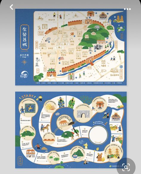
Graphic Design Portfolio BookMaps IllustrationMap BrochuresBook Illustration LayoutMap WorksheetsMap LayoutDm DesignMap IllustrationBoard Game DesignGraphic Design Portfolio Book2.9k
World Map Blank PrintableOutline World MapBlank Map Of The WorldBlank World Map With CountriesBlank World Map Printable FreeWorld Map Printable FreeWorld Map Outline PrintableFree Printable World Map With CountriesOutline Of World MapLarge Blank World Maps - 10 Free PDF Printables | PrintableeUsing Large blank world maps printable can significantly enhance your learning or teaching experience. If youre a student, you can practice labeling countries, cities, and geographical features to improve your geography knowledge.2.7k
Swift CodeApp Store IconMap IconsLocation IconRed MonochromeFree MapsCute AppHalloween FontsApp CoversMap free icons designed by FreepikFree vector icon. Download thousands of free icons of maps and location in SVG, PSD, PNG, EPS format or as ICON FONT #flaticon #icon #map #location #googlemaps1.6k
Maps IllustrationMap InfographicThunder DragonInfographic MapIllustrated MapsMap IdeasMap IllustrationInfographic PosterInformation DesignMap Design - Infographic - Ashmi ShahGraphic Design, Adobe Illustrator3.8k
Treasure Maps For KidsPirate WeekPirate MapPirate Coloring PagesPirate ActivitiesPirate Party IdeasPirate CraftsPirates PartyPirate Treasure MapsPrintable Treasure Map Kids Activity – Let's DIY It All – With Kritsyn MerkleyPrintable Treasure Map Kids Activity - a fun summer activity with the kids complete with Printable Pirate Maps and golden rocks.14.2k
Map Art IllustrationMaps IllustrationHand Drawn MapsMaps DesignIllustration MapMap IllustrationsMap SketchVisuell IdentitetMental MapMap Art Illustration387
Creative Map Design IllustrationGame Maps DesignGame Map Concept ArtDigital Map DesignMap Illustration Design GraphicsAlex PasquarellaConcept Map Ideas CreativeCreative Map DesignIllustrative MapCreative Map Design Illustration220
Urban Planning IllustrationMall Map DesignDigital Map DesignLocation Map Design GraphicsMap Location DesignMap Layout DesignInfographic Map DesignMap Illustration Design GraphicsSimple Map DesignUrban Planning Illustrationinspiration, map, design letter,1.2k