Resolute Bay
Bay in the Qikiqtaaluk Region of Nunavut, Canada From Wikipedia, the free encyclopedia
Resolute Bay is an Arctic waterway in the Qikiqtaaluk Region, Nunavut, Canada. Named after the Arctic exploration vessel HMS Resolute,[3] it is located in Parry Channelmap on the southern side of Cornwallis Island.map The hamlet of Resolutemap is located on the northern shore of the bay with Resolute Bay Airportmap to the northwest. The Inuit associated with Resolute Bay are called Qausuittuq[4] and the population of the hamlet in the 2021 census was 183.[5]
| Resolute Bay | |
|---|---|
 Looking west along the edge of Resolute Bay. | |
 Resolute Bay | |
| Location | Parry Channel |
| Coordinates | 74°41′N 094°50′W[1] |
| Ocean/sea sources | Arctic Ocean |
| Basin countries | Canada |
| Settlements | Resolute |
On the western shore, the Defence Research Telecommunications Establishment (DRTE) and the Communications Research Centre Canada[6] operated a launch site for sounding rockets.map Between 1966 and 1971 rockets of the types Black Brant and Boosted Arcas were launched.[7][8]
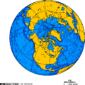 Orthographic projection centred over Resolute Bay, Nunavut, Canada.
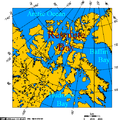 Resolute Bay, Nunavut, Canada - Lambert Projection.
 Resolute Bay: View from Signal Hill to the Inuit-Settlement "Village" and to Resolute Passage (August 1997)
 Another view over Resolute Bay to the Inuit Settlement "Village" (August 1997)


References
Further reading
Mapping
Wikiwand - on
Seamless Wikipedia browsing. On steroids.