Christmas and new year outlook
Sorry, snow lovers!
There won’t be a white Christmas this year. Again. (to be fair, the chance runs at about 1%). It would be nice to get one, but the reality is that measurable snow chances typically lay further into the new year.
We’ve had a few December teases, with Friday evening’s quick shot of wet snow registering trace amounts in a few locations in Sussex county. But the coming week will feature a slow moderating trend with Christmas Day temperatures running close to average for this time of the year (average high is 48 in Salisbury).
Dry weather will dominate the week as well, so holiday travel is looking good in our region. Looking ahead to the final week of the year, the trend will be to moderate a bit more, with highs likely into the 50s. A system will potentially bring rain chances back to Delmarva Sunday and/or Monday.
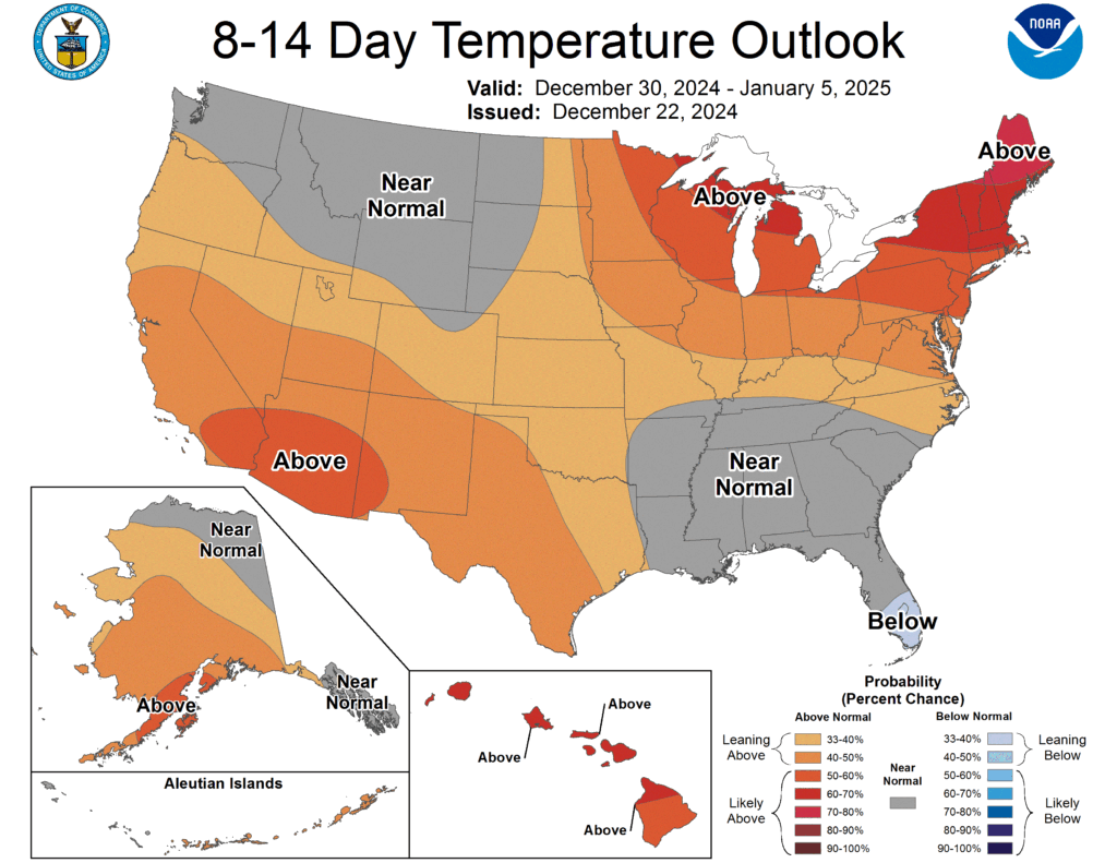
And how about the first days of 2025? The above average temperature trend continues. But signals point toward the polar jet taking a dip in our direction not too far into the new year. There is little to no skill in forecasting specifics beyond a 7 day period, so we don’t know if this will be a snow setup. However, temperature trends can be forecasted further out with some skill, and so far, it looks like some cold air awaits us soon into January.


