Category:1910s maps of Indonesia
Jump to navigation
Jump to search
Media in category "1910s maps of Indonesia"
The following 24 files are in this category, out of 24 total.
-
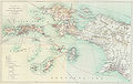
 Map of Buitenzorg (Baedeker, 1914).jpg 983 × 1,508; 1.39 MB
-
 Java, Sumatra and the other islands of the Dutch East Indies (1914) (14577083058).jpg 1,984 × 2,264; 817 KB
-
 NetherlandsNewGuinea-1916.jpg 3,000 × 1,895; 6.3 MB
-
 UB Utrecht - Nova Guinea Vol 4 - Karte 1 - Ternate.jpg 1,496 × 1,930; 1.64 MB
-

-

-
 Borneo WDL477.png 1,024 × 1,506; 2.22 MB
-

-
 Central-Celebes, Celebes. Kartor utvisande Dr - SMVK - 2034D.tif 3,369 × 2,025; 39.07 MB
-

-

-

-
 PCA Timor Annexe I.jpg 1,356 × 900; 719 KB
-
 PCA Timor Annexe II.jpg 1,366 × 900; 775 KB
-
 PCA Timor Annexe III.jpg 900 × 1,394; 544 KB
-
 PCA Timor Annexe IV.jpg 900 × 1,364; 565 KB
-
 PCA Timor Annexe V.jpg 1,546 × 2,448; 1.39 MB
-
 PCA Timor Annexe VI.jpg 900 × 1,403; 788 KB
-
 PCA Timor Annexe VII.jpg 1,608 × 2,514; 1.36 MB
-
 PCA Timor Annexe A.jpg 7,016 × 4,960; 1.61 MB
-
 PCA Timor Annexe B.jpg 4,960 × 7,016; 1.64 MB
-
 PCA Timor Annexe C.jpg 4,960 × 7,016; 2.25 MB
-
 Timor 1914.png 3,602 × 2,487; 626 KB
-
 Westtimor 1911.png 2,296 × 1,796; 1.19 MB
.jpg)
_(14577083058).jpg)


_(14761128861).jpg)
_(14577256677).jpg)
_(14577225917).jpg)


