Category:1929 maps of Lithuania
Jump to navigation
Jump to search
Media in category "1929 maps of Lithuania"
The following 4 files are in this category, out of 4 total.
-
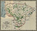 Litwa 1929.jpg 1,833 × 1,542; 437 KB
-
 Mapa rozsiedlenia ludności polskiej na terenie Litwy w 1929.jpg 9,754 × 7,382; 9.79 MB
-
 Transport map of Lithuania with distances, 1929.jpg 9,000 × 7,558; 11.03 MB
-


.jpg)