Category:Ellsworth Mountains
Jump to navigation
Jump to search
highest mountain ranges in Antarctica   | |||||
| Upload media | |||||
| Instance of | |||||
|---|---|---|---|---|---|
| Named after | |||||
| Location | Antarctic Treaty area | ||||
| Discoverer or inventor | |||||
| Has part(s) | |||||
| Width |
| ||||
| Length |
| ||||
| Highest point | |||||
| Area |
| ||||
| Elevation above sea level |
| ||||
 | |||||
Subcategories
This category has the following 4 subcategories, out of 4 total.
Media in category "Ellsworth Mountains"
The following 34 files are in this category, out of 34 total.
-
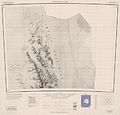
 C78082s1 Ant.Map Vinson Massif.jpg 3,849 × 3,247; 1.43 MB
-
 C80077s1 Ant.Map Liberty Hills.jpg 4,204 × 3,238; 1.52 MB
-
 Craddock-Massif-and-Vinson-Plateau.jpg 1,200 × 795; 319 KB
-
 Ellsworth Mountains.png 4,692 × 9,150; 30.57 MB
-
 Ellsworth Range.jpg 3,648 × 2,048; 4.39 MB
-
 Ellsworth-Mountains-location-map.png 1,600 × 1,260; 3.04 MB
-
 EM location map.png 2,000 × 1,414; 1.4 MB
-
 Evolutionary Diagram of Cambrian Rift of the Ellsworth Mountains.jpg 1,522 × 2,153; 350 KB
-
 Evolutionary diagram of the Ellsworth Mountains.jpg 1,522 × 2,153; 356 KB
-
 Final Column.png 2,000 × 1,414; 270 KB
-
 Geological Cross Section of the Ellsworth Mountains.jpg 2,000 × 1,415; 263 KB
-
 Geological Map of Ellsworth Mountains (1969).jpg 1,668 × 1,179; 177 KB
-
 Geological Map of Ellsworth Mountains (1986) with Cross Sections A-A' and B-B'.png 2,000 × 1,414; 753 KB
-
 Geological Map of the Ellsworth Mountains.png 2,000 × 1,414; 180 KB
-
 Geological Stratigraphic of the Ellsworth Mountains.png 2,000 × 1,414; 340 KB
-
 Heritage-Range-location-map.png 1,600 × 1,260; 3.04 MB
-
 Horseshoe Valley.jpg 2,373 × 1,579; 3.57 MB
-
 Liberty-Hills.jpg 3,354 × 3,093; 1.33 MB
-
 Mount Gardner from SW by Christian Stangl (flickr).jpg 1,400 × 957; 998 KB
-
 Mount Press, Ellsworth Mountains, Antarctica.jpg 1,000 × 708; 48 KB
-
 Mount Shinn from North East by Christian Stangl (flickr).jpg 1,400 × 930; 1,003 KB
-
 Mount Tyree (Antarctica) from East by Christian Stangl (flickr).jpg 1,400 × 901; 814 KB
-
 Mount Vinson from NW at Vinson Plateau by Christian Stangl (flickr).jpg 1,400 × 991; 567 KB
-
 Northern-Sentinel-Map.jpg 3,222 × 3,078; 5.3 MB
-
 Sentinel Range, Ellsworth Mountains, Antarctica.jpg 2,000 × 1,325; 1.08 MB
-
 Topographic Map of Ellsworth Mountains with interval of 100m.png 2,000 × 1,414; 1.13 MB
-
 Topographic map of the Ellsworth Mountains with an interval of 100m.png 2,000 × 1,414; 1.62 MB
-
 Union-Glacier.jpg 4,267 × 3,085; 1.82 MB
-
 Updated Evolutionary Diagram of Cambrian Rift of Ellsworth Mountains.png 1,414 × 2,000; 1,020 KB
-
 Updated Stratigraphic 3.png 2,000 × 1,414; 338 KB
-
 Updated Stratigraphic 4.png 2,000 × 1,414; 342 KB
-
 Updated Stratigraphic.png 2,000 × 1,414; 301 KB
-
 UUpdated Stratigraphic.png 2,000 × 1,414; 312 KB
-
 Vinson-Map.jpg 3,207 × 3,070; 5.48 MB


.jpg)
_with_Cross_Sections_A-A%27_and_B-B%27.png)


.jpg)

.jpg)
_from_East_by_Christian_Stangl_(flickr).jpg)
.jpg)


