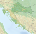
Category:Location maps of Croatia
Jump to navigation
Jump to search
| This category should only contain blank "Location maps" created for geo-location purposes which follow a same uniform standard, and have been created with a Geographic information system (GIS) software program using a compatible equirectangular or conical projection and for which the geographic coordinate system is known. For more information or questions see the wikiproject: German Wikipedia:Kartenwerkstatt/Positionskarten and this discussion page. |
Subcategories
This category has only the following subcategory.
L
Media in category "Location maps of Croatia"
The following 16 files are in this category, out of 16 total.
-
Croatia - Central Croatia - relief map.png 1,889 × 1,812; 8.5 MB
-
Croatia - East Croatia - Slavonia - relief map.png 1,562 × 1,248; 4.69 MB
-
Croatia - South Croatia - Dalmatia - relief map.png 2,244 × 2,037; 7.63 MB
-
Croatia - West Croatia - Istria - Croatian Littoral - Lika - Gorski kotar - relief map.png 1,522 × 1,240; 3.68 MB
-
Croatia location map - Central Croatia.svg 548 × 526; 207 KB
-
Croatia location map - Dalmatia.svg 650 × 592; 207 KB
-
Croatia location map - East Croatia.svg 453 × 362; 207 KB
-
Croatia location map - West Croatia.svg 440 × 359; 207 KB
-
Croatia location map.svg 1,097 × 1,062; 480 KB
-
Croatia relief map.png 731 × 707; 882 KB
-
LocationmapCroatia.png 619 × 599; 98 KB
-
Relief map of Croatia.png 1,888 × 1,823; 4.92 MB
-
Relief Map of Croatia.png 631 × 604; 410 KB
-
Relief Map of Croatia.svg 631 × 604; 4.23 MB
-
Reliefkarte Kroatien schaerfer.png 3,786 × 3,646; 26.77 MB
-
Reliefkarte Kroatien.png 3,786 × 3,646; 17.26 MB


