Category:Stauffenbergallee (Erfurt)
Jump to navigation
Jump to search
| Object location | | View all coordinates using: OpenStreetMap |
|---|
street in Erfurt, Thuringia, Germany | |||||
| Upload media | |||||
| Instance of | |||||
|---|---|---|---|---|---|
| Location | Erfurt, Thuringia, Germany | ||||
 | |||||
Namensgebungen:
jjjj - jjjj: Wilhelm-Pieck-Straße
jjjj - heute: Staufenbergallee
Subcategories
This category has the following 2 subcategories, out of 2 total.
P
- Promenadendeck (Erfurt) (1 F)
Media in category "Stauffenbergallee (Erfurt)"
The following 9 files are in this category, out of 9 total.
-

-
 Schmidtstedter Knoten Süd Erfurt.JPG 1,600 × 1,200; 448 KB
-
 Altstadt, Erfurt, Germany - panoramio.jpg 2,511 × 1,831; 1.47 MB
-
 Thämannstraße 1-3.jpg 1,194 × 1,200; 238 KB
-
 Schapirostraße Erfurt.JPG 1,600 × 1,200; 415 KB
-
 Schmidtstedter Knoten Nord Erfurt.JPG 1,600 × 1,200; 471 KB
-
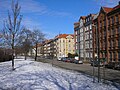 Stauffenbergallee Erfurt.JPG 1,600 × 1,200; 448 KB
-
 Villa North Erfurt 1.JPG 2,304 × 3,072; 2.05 MB
-
 Villa North Erfurt 2.JPG 3,072 × 2,304; 1.8 MB


