The purpose of this project is to create dynamic visualizations of earthquakes based on magnitude and location relative to tectonic plates. The USGS API was called to gather GeoJSON data and then transform that data three maps with an index, markers, and map toggle.
Knowledge of JavaScript, Leaflet.js, Mapbox styles, d3.json, and geoJSON data.
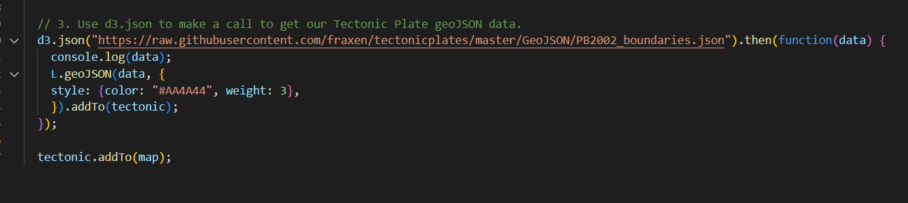
Deliverable 1: Add Tectonic Plate Data

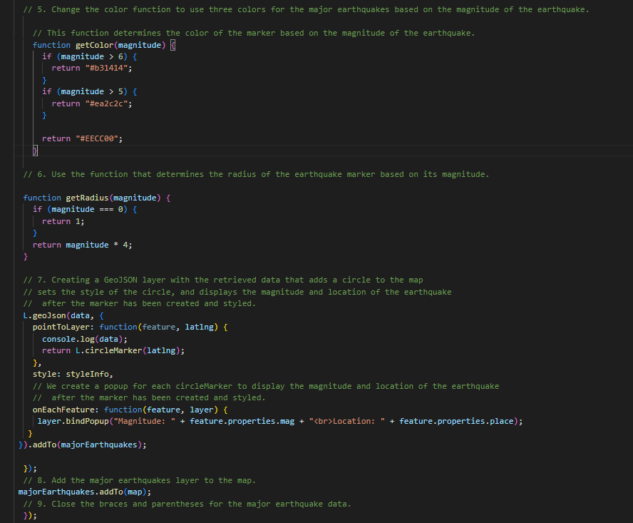
Deliverable 2: Add Major Earthquake Data

Deliverable 3: Add an Additional Map

