Public Tags
Showing images tagged with place:Mansfield tag.

|
Mansfield Station
by John Sutton geograph for square SK5360 In the days of steam Mansfield Town station had an overall roof. It closed in... (more)
Tags:
top:City, Town CentreX
type:GeographX
place:Mansfield
Midland RailwayX
place:NottinghamshireX
top:RailwaysX
|

|
Northbound at Mansfield
by John Sutton geograph for square SK5360 A train from Nottingham about to leave for Mansfield Woodhouse on a cold, wet... (more)
|

|
A Mansfield Woodhouse train leaving Mansfield
by John Sutton geograph for square SK5360 Trains from Nottingham terminate either at Worksop or Mansfield Woodhouse. The... (more)
|
|
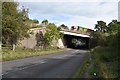
A38 over B4151 - Roughley, West Midlands
by Martin Richard Phelan geograph for square SP1499 On the B4151 Slade Road looking eastwards towards Canwell. The B4151 runs as... (more)
Tags:
A38 RoadX
A4148 RoadX
A453 Tamworth RoadX
B4151 Slade RoadX
place:BodminX
place:CanwellX
place:Carroway HeadX
area:CornwallX
Devonshire ExpresswayX
type:GeographX
top:GrasslandX
top:LowlandsX
M6 Toll MotorwayX
place:Mansfield
area:NottinghamshireX
subject:RoadX
top:Roads, Road TransportX
area:StaffordshireX
top:Suburb, Urban FringeX
Sutton RoadX
place:WalsallX
|
|
A38 glance back - Canwell, Staffordshire
by Martin Richard Phelan geograph for square SP1499 Looking back to where the A38 crosses above the B4151 Slade Road on its 292... (more)
|

|
Mansfield Bus Station
by John Sutton geograph for square SK5360 The elevated walkway to the railway station is on the left, the railway viaduct... (more)
Tags:
top:Air, Sky, WeatherX
top:City, Town CentreX
type:GeographX
place:Mansfield
top:PathsX
top:Roads, Road TransportX
season:SummerX
ViaductX
|

|
Mansfield: Albert Street and the railway viaduct
by John Sutton geograph for square SK5360 The Nottingham-Worksop railway line, built by the Midland Railway, crosses the... (more)
Tags:
top:Air, Sky, WeatherX
top:Business, Retail, ServicesX
top:City, Town CentreX
type:GeographX
place:Mansfield
top:RailwaysX
top:Roads, Road TransportX
season:SummerX
ViaductX
|

|
Mansfield: St Peter - nave and chancel
by John Sutton for square SK5461 "The main impression today is due to c 1300," wrote Nikolaus Pevsner.... (more)
Tags:
top:City, Town CentreX
top:Historic Sites and ArtefactsX
type:InsideX
place:Mansfield
place:NottinghamshireX
top:Religious SitesX
|

|
Mansfield: along Church Street
by John Sutton geograph for square SK5361 Looking from the Market Place towards the railway viaduct and the parish church... (more)
Tags:
top:Air, Sky, WeatherX
top:Business, Retail, ServicesX
top:City, Town CentreX
type:GeographX
top:Historic Sites and ArtefactsX
place:Mansfield
top:RailwaysX
top:Religious SitesX
season:SummerX
|

|
Mansfield: a wet summer morning in Leeming Street
by John Sutton geograph for square SK5361 Looking towards the Market Place and the Town Hall.
Tags:
top:Air, Sky, WeatherX
top:Business, Retail, ServicesX
top:City, Town CentreX
type:GeographX
place:Mansfield
top:Public Buildings and SpacesX
season:SummerX
|

|
Mansfield Cemetery Gateway
by Graham Hogg geograph for square SK5459 This is the principal entrance to this large cemetery
|

|
Approaching Mansfield
by Graham Hogg geograph for square SK5358 On the A611 road, with the West Nottinghamshire College in the background. SK5458 : West Nottinghamshire College
Tags:
College BuildingsX
place:Mansfield
top:Roads, Road TransportX
Town Boundary SignX
top:Village, Rural SettlementX
|

|
Platform art, Mansfield railway station
by Graham Hogg geograph for square SK5360 The design is the logo for the recently created Robin Hood Line... (more)
|

|
Parking Zone View
by Gordon Griffiths geograph for square SK5660 The view at Tesco Extra Mansfield off Jubilee Way South.
Tags:
top:Business, Retail, ServicesX
Car ParkX
type:GeographX
place:Mansfield
county:NottinghamshireX
subject:SupermarketX
Tesco ExtraX
|

|
Mansfield: The Railway Inn
by John Sutton geograph for square SK5360 Station Street on a wet June morning.
Tags:
top:Air, Sky, WeatherX
top:City, Town CentreX
top:Construction, DevelopmentX
type:GeographX
place:Mansfield
top:Roads, Road TransportX
season:SummerX
|

|
Mansfield: White Hart Street
by John Sutton geograph for square SK5360 The corner of Albert Street, with the railway viaduct on the left, on a wet... (more)
Tags:
top:Air, Sky, WeatherX
top:Business, Retail, ServicesX
top:City, Town CentreX
type:GeographX
place:Mansfield
top:RailwaysX
season:SummerX
ViaductX
|

|
Mansfield: down Toothill Lane
by John Sutton geograph for square SK5461 Looking towards Bridge Street and the parish church on a wet morning in late June.
Tags:
top:Air, Sky, WeatherX
top:Business, Retail, ServicesX
top:City, Town CentreX
type:GeographX
top:Historic Sites and ArtefactsX
top:Housing, DwellingsX
place:Mansfield
top:Religious SitesX
season:SummerX
|

|
The approach to Mansfield Station
by John Sutton geograph for square SK5360 The ramp leading to the Nottingham-bound platform, photographed on a cold, wet... (more)
|

|
Tesco Extra
by Gordon Griffiths geograph for square SK5660 The view at Tesco Mansfield off Jubilee Way South.
Tags:
top:Business, Retail, ServicesX
type:GeographX
place:Mansfield
county:NottinghamshireX
subject:SupermarketX
Tesco ExtraX
|

|
Click and Collect
by Gordon Griffiths geograph for square SK5659 The view on Tesco Mansfield off Jubilee Way South.
Tags:
top:Business, Retail, ServicesX
Click and Collect GroceriesX
type:GeographX
place:Mansfield
county:NottinghamshireX
subject:SupermarketX
Tesco ExtraX
|

|
Rushley Farm
by Graham Hogg geograph for square SK5458 Tags:
top:Farm, Fishery, Market GardeningX
place:Mansfield
|

|
Horses and caravans on Fishpond Hill
by Graham Hogg geograph for square SK5161 Tags:
CaravanX
top:Farm, Fishery, Market GardeningX
type:GeographX
subject:HorseX
HorsesX
place:Mansfield
top:Sport, LeisureX
top:Suburb, Urban FringeX
|

|
Bus passing by on Winthorpe Street
by Graham Hogg geograph for square SK5160 |

|
Outside the Flying High Academy
by Graham Hogg for square SK5161 A newly built primary school proud of its first Ofsted report.
Tags:
type:Close LookX
top:Educational SitesX
place:Mansfield
Primary SchoolX
subject:SchoolX
top:Suburb, Urban FringeX
|

|
Public footpath in Ladybrook
by Graham Hogg geograph for square SK5261 Running between Clarendon Road and the grounds of the Flying High Academy, a... (more)
Tags:
top:Educational SitesX
FootpathX
type:GeographX
top:Housing, DwellingsX
place:Mansfield
subject:PathX
top:PathsX
top:Suburb, Urban FringeX
|

|
Old Water Lane
by Graham Hogg geograph for square SK5162 'New' Water Lane is a few yards to the left, the old lane now... (more)
Tags:
subject:GatewayX
type:GeographX
top:Housing, DwellingsX
place:Mansfield
top:Roads, Road TransportX
top:Suburb, Urban FringeX
|

|
The Rufford
by Graham Hogg geograph for square SK5262 A large public house and restaurant where a carvery lunch cost just �3.99
Tags:
top:Business, Retail, ServicesX
type:GeographX
place:Mansfield
subject:Public HouseX
Public House & RestaurantX
top:Suburb, Urban FringeX
|

|
The Black Bull
by Graham Hogg geograph for square SK5462 Large pub on Woodhouse Road to the north of the town centre
Tags:
top:Business, Retail, ServicesX
place:Mansfield
subject:Public HouseX
Public HouseX
top:Suburb, Urban FringeX
|

|
After Dark
by Graham Hogg geograph for square SK5361 A night club in Leeming Street, the heart of the evening entertainment quarter... (more)
Tags:
top:Business, Retail, ServicesX
top:City, Town CentreX
subject:ClubX
place:Mansfield
Night ClubX
|

|
Leaning man seat
by Graham Hogg geograph for square SK5461 Public art with a secondary purpose as a seating area
|

|
ghost Academy of Performing Arts
by Graham Hogg geograph for square SK5460 On Church Lane in the town centre
|

|
Industrial premises on Sheepbridge Lane
by Graham Hogg geograph for square SK5259 |

|
Paddock Close
by Graham Hogg geograph for square SK5359 Large, modern housing to the south west of the town centre.
|
|
|
West Nottinghamshire College
by Graham Hogg geograph for square SK5458 The college offers education and training to over 20,000 students and is one of... (more)
|

|
Tibshelf Motorway Services, southbound
by Stanley Howe geograph for square SK4460 Bus park at this half-way comfort stop between County Durham and Wembley, for... (more)
|