Long lat
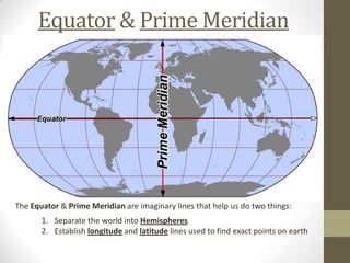
- 1. Equator & Prime Meridian The Equator & Prime Meridian are imaginary lines that help us do two things: 1. Separate the world into Hemispheres 2. Establish longitude and latitude lines used to find exact points on earth
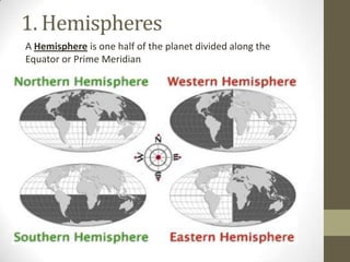
- 2. 1. Hemispheres A Hemisphere is one half of the planet divided along the Equator or Prime Meridian
- 3. 2. Latitude & Longitude • Lines of Latitude- horizontal lines on a map that mark the distance north or south of the Equator • On your sheet, label the Equator and trace the lines of latitude to make them bold
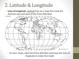
- 4. 2. Latitude & Longitude • Lines of Longitude- vertical lines on a map that mark the distance east and west of the Prime Meridian • On your sheet, label the Prime Meridian and trace the lines of longitude to make them bold
- 5. Degrees • Degrees – The unit for measuring distance on a map • Latitude lines begin at the Equator (0°) and go North & South up to 90° • Longitude lines begin at the Prime Meridian (0°) and go West & East up to 180°


