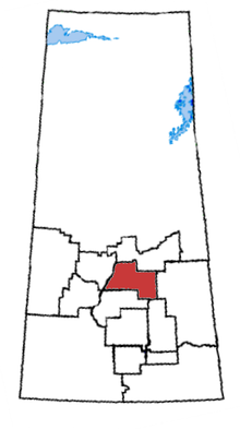
3포크스 그룹
Three Forks Group| 3포크스 그룹 Stratigraphic 범위:Tournaisian PreꞒꞒ에Famennian OSDCPTJKPg N. | |
|---|---|
| 유형 | Geologic 그룹 |
| Sub-units | 박켄 형성, Lyleton 형성, 빅 밸리 형성, 토키 형성. |
| Underlies | 매디슨 그룹 |
| Overlies | 서스캐처원 그룹 |
| 두께 | 35미터(110피트)에 80미터(260피트)[1]. |
| Lithology | |
| 1차 | Dolomite, 이암, 셰일 |
| 위치 | |
| 지역 | 서양 캐나다 Sedimentary 분지, 윌리 분지. |
| 나라 | |
| 매개 변수 형식 섹션 | |
| 아픔을 | 3의 포크스 몬타나 |
| 에 의해 명명된 | AC펄, 1893년 |
Famennian 시대의 윌리 분지에 세 아기 포크스 그룹은 층서적 단위이다.
그것은 3의 포크스 몬타나의 도시에서 처음으로 노출된 곳에 도시 근처의 AC로 소개되었다 그 이름펄 1893년(세 포크스 이판암 지구에)에.[2]
Lithology
세 아기 포크스 그룹 Dolomite, 이암과 역청 혈암으로 구성되어 있다.[1]
Hydrocarbon 생산
윌리스톤 분지 지하에서는 삼포크(Three Forks)를 삼포크(Three Forks)형성([3]Three Forks Formation)이라고 하는데, 이 포크는 아래의 새곰형성(Birdbear Formation)과 위의 박켄형성 사이에 있다.
노스다코타주 윌리스턴 분지 및 남동쪽 사스카처원의 삼포크 형성으로부터 생산된 석유는 종종 위에 있는 바켄 형성과 함께 생산 통계에 포함된다.예를 들어, Three Forks와 Bakken은 2013년 4월 30일 미국 지질조사국이 발표한 잠재적 생산량 추정치에 통합되었다.USGS의 추산에 따르면, 현재의 기술을 이용하여 74억 배럴의 석유를 바켄과 삼포크 형성과 6조 7천억 입방피트의 천연가스, 5억 3천만 배럴의 천연가스 액체를 회수할 수 있다고 한다.[4][5][6]
분배
삼포크 그룹은 최대 두께가 80m(260ft)에 이르지만 두께는 35m(110ft)까지 얇을 수 있다.[1]
행정 구역
| 서브유닛 | 나이 | Lithology | 맥스. 두께 | 참조 |
|---|---|---|---|---|
| 박켄 포메이션 | 킨더후키안 | 유연성의 셰일 | 40m(130ft) | [7] |
| 라일턴 포메이션 | 파메니아어 | 붉은 돌로마이트 및 실티 셰일, 아질질질 돌로마이트 | 40m(130ft) | [8] |
| 빅 밸리 포메이션 | 파메니아어 | 흙돌 | 40m(130ft) | [9] |
| 토르카이 포메이션 | 파메니아어 | 갈색 돌로마이트, 셰일 | 65m(제곱 피트) | [10] |
다른 계열과의 관련성 분석
세 가지 포크스 그룹은 Saskatchewan 그룹보다 순응적으로 우선하며 Madison 그룹에 의해 부적절하게 중첩된다.[1]
와바문 그룹과 알버타 엑쇼 포메이션의 합계에 해당한다.
참조
- ^ a b c d Lexicon of Canadian Geologic Units. "Three Forks Group". Archived from the original on 2009-04-16. Retrieved 2010-01-01.
- ^ 기원전 1893년, 필레.몬태나주 스리 포크 인근의 고생대 구간.US GS, Bull. 110, 페이지 9-56
- ^ 2013년 1월 6일 미국 지질조사국 세 포크가 접속했다.
- ^ "Archived copy". Archived from the original on 2013-10-29. Retrieved 2013-05-01.
{{cite web}}: CS1 maint: 타이틀로 보관된 사본(링크) - ^ Lenny Bernstein (April 30, 2013). "Northern plains site has twice as much oil as previously thought, Interior says". The Washington Post. Retrieved May 1, 2013.
The doubling of the estimate resulted largely because of the first look at the Three Forks Formation in North Dakota, which the Geological Survey said contains 3.73 billion barrels of oil. Its reassessment of the Bakken Formation, which lies above Three Forks, showed 3.65 billion barrels, only a little more than a 2008 USGS estimate. The agency’s conclusion that the formations contain 6.7 trillion cubic feet of natural gas and 530 million barrels of natural gas liquids represented a tripling of previous estimates.
- ^ Stephanie B. Gaswirth; Kristen R. Marra; Troy A. Cook; Ronald R. Charpentier; Donald L. Gautier; Debra K. Higley; Timothy R. Klett; Michael D. Lewan; Paul G. Lillis; Christopher J. Schenk; Marilyn E. Tennyson; Katherine J. Whidden. "National Assessment of Oil and Gas Fact Sheet Assessment of Undiscovered Oil Resources in the Bakken and Three Forks Formations, Williston Basin Province, Montana, North Dakota, and South Dakota, 2013" (PDF). Fact Sheet 2013–3013. United States Geological Survey. Retrieved May 1, 2013.
Using a geology-based assessment methodology, the U.S. Geological Survey estimated mean undiscovered volumes of 7.4 billion barrels of oil, 6.7 trillion cubic feet of associated/dissolved natural gas, and 0.53 billion barrels of natural gas liquids in the Bakken and Three Forks Formations in the Williston Basin Province of Montana, North Dakota, and South Dakota.
- ^ Lexicon of Canadian Geologic Units. "Bakken Formation". Retrieved 2010-01-03.
- ^ Lexicon of Canadian Geologic Units. "Lyleton Formation". Retrieved 2010-01-03.
- ^ Lexicon of Canadian Geologic Units. "Big Valley Formation". Retrieved 2010-01-03.
- ^ Lexicon of Canadian Geologic Units. "Torquay Formation". Retrieved 2010-01-03.


