

It was envisioned long ago as a connector to join the Cross Florida Greenway and the Withlacoochee State Trail together to benefit the route of the statewide Florida Trail.
Stretching between two trailheads, the paved Dunnellon Trail crosses the cypress-lined banks of the Withlacoochee River on a massive bridge with great views.
 Bridge over the Withlacoochee River
Continuing into a vast floodplain where rivers meet, the paved path lets hikers keep their feet dry while immersing in the grandeur of the surrounding swamp forest.
A 2.3 linear route between trailheads, this trip makes for a 4.6 mile round-trip, with the potential of adding extra miles with a walk through neighboring Blue Run Park.
 Enjoy leafy shade in the floodplain portion of the hike
Our Florida Trail Books & Guides


Disclosure: As authors and affiliates, we receive earnings when you buy through our links. This helps us provide public information on this website.
Overview
Location: Dunnellon
Length: 2.3 miles linear
Trailhead: 29.03125, -82.45610
Address: 1239 Withlacoochee Trail, Dunnellon
Fees: Free
Restroom: Portable toilets
Land manager: Cross Florida Greenway
Phone: 352-236-7143
Open 8 AM to sunset. No potable water or designated campsites provided. Leashed pets welcome.
Orange blazes on pavement mark the Florida Trail route. Cyclists and hikers share the trail. This entire route is paved and accessible, with multiple benches along it.
Additional trailheads are at Bridges Rd, the end of this paved segment of trail, and off a spur trail at Blue Run Park along CR 484 just east of the Rainbow River.

Directions
Just off US 41 south of Dunnellon, the CR 39 trailhead is immediately east of the intersection of the two highways. Follow the long access road up to the parking area. Both alternative trailheads are off CR 484 east of downtown Dunnellon. The road to the Bridges Rd trailhead is unpaved and very rough.
Hike
Two paved paths join at the CR 39 trailhead: one coming in from the highway, the other from an underpass beneath US 41.
The underpass route extends the Withlacoochee State Trail to reach the Marjorie Harris Carr Cross Florida Greenway at this point in Dunnellon.
 Expect to encounter many cyclists on this trail
Your hike starts at the trailhead kiosk with a map of the route, and is flanked by a dense forest of oaks and pines in climax sandhill habitat.
The trail curves along a former railroad route with a broad grassy berm. Shade begins in earnest as the trail enters the floodplain forest of the Withlacoochee River.
 Broad corridor edged by sandhills
The big bridge over the Withlacoochee River fills the horizon ahead. Reach it at 0.8 mile and enjoy the views from the top.
Observation platforms provide a place from which to watch birds, boaters, and alligators along this cypress-lined waterway.
 Withlacoochee River below the bridge
The far end of the bridge has a bench cleverly built into it. Walk through the deep shade of the floodplain forest for the next half mile, admiring the cypress swamps.
These are in the confluence where the spring-fed Rainbow River pours into the Withlacoochee River.
 Floodplain swamp
Fences and gates on both sides of the trail provide private access for residents of a small community to cross the trail to their swimming hole.
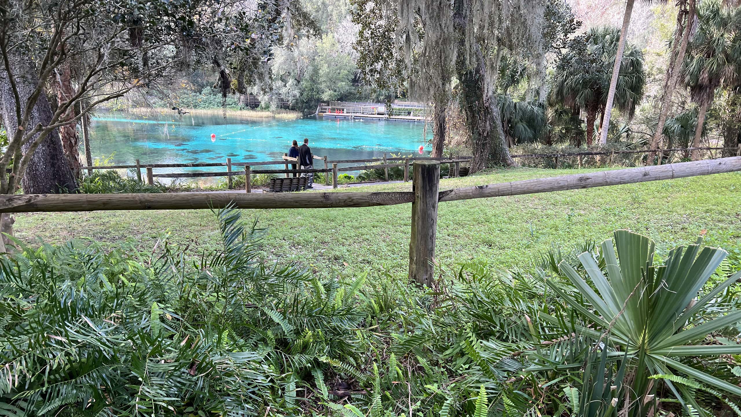
Catch glimpses of the Rainbow River beyond the thicket of trees along its shoreline.
 View of the Rainbow River
At 1.3 miles, the trail reaches a curve with a trail junction at a bench. The path to the left leads into Blue Run Park, ending at its trailhead on CR 484.
 Blue Run of Dunnellon Park Enjoy a gentle family-friendly hike along the Rainbow River at Blue Run of Dunnellon Park, where woodland footpaths and paved trails keep you mostly in the shade with dry feet as you explore the river floodplain.
Long distance hikers wanting to access services in Dunnellon should take that route, which reaches the road into town in a quarter mile.
 Path to the left leads to Dunnellon
Home to a popular launch and take-out along the Rainbow River, Blue Run Park also has a network of footpaths looping through uplands habitats.
You encounter a junction with that loop on the left where the main trail curves out of the floodplain and into the sunshine.
 Road crossing at San Jose Blvd
Cross paved San Jose Blvd. The trail makes a sharp turn to the right to leave the powerline easement for a short jog through the sandhills
Losing a slight amount of elevation, the trail swoops around to pass a series of ballfields.
 Hiking through the sandhills
After the ballfields, this paved section ends at the trailhead on Bridges Rd after 2.3 miles.
There is usually a portalet in place but no water. If you’re backpacking, walk to the ballfields to find a spigot. Day hikers will turn around here for a 4.6 mile hike.
 Enjoy the deep shade on the return
NORTHBOUND: Pruitt to Ross Prairie
SOUTHBOUND: Withlacoochee State Trail
For long distance hikers doing the full Cross Florida Greenway, it’s 4.9 miles between Bridges Rd trailhead and Pruitt trailhead.
Make a left out of the Bridges Rd trailhead and look for a gap in the fence on the right.
 Gap in the fence
Follow orange blazes for 1.5 miles as the trail makes three 90-degree turns through planted pines to reach CR 484 within sight of the traffic light at SW 180th Ave Rd.
Emerge through a gap in the fence onto the road shoulder. Keep well away from the pavement along this 3.4 mile roadwalk on high-speed two-lane CR 484.
On the right, the Pruitt trailhead entrance has a large sign. Follow the entrance road to the trailhead.
 Withlacoochee State Trail Tracing 44 miles of railroad history down forested corridors, past big lakes and city parks, and through quaint communities, the Withlacoochee State Trail is one sweet ride
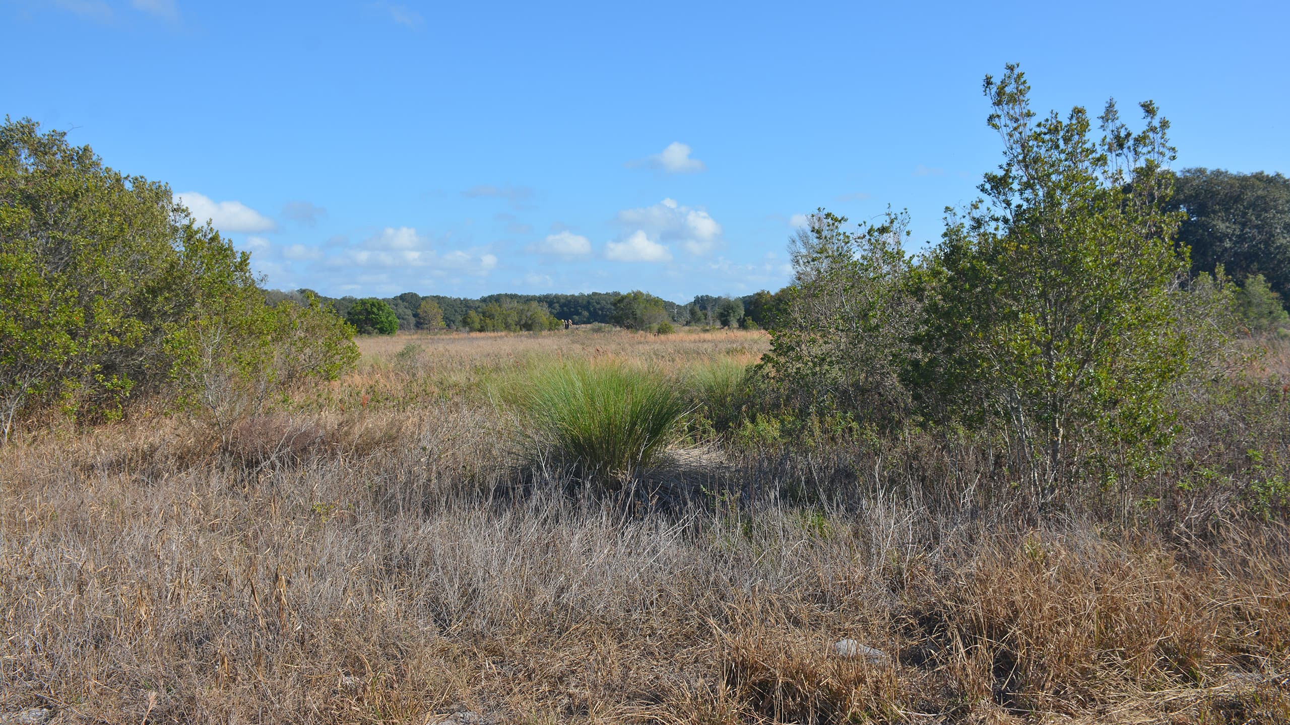 Florida Trail, Pruitt to Ross Prairie 7.5 miles. With switchbacks, scrambles, and ancient oaks, the Pruitt section of the Florida Trail along the Cross Florida Greenway offers a fascinating hike into the history of the Cross Florida Ship Canal.
Suggested Articles
 Florida Trail Backpacking Backpackers will appreciate the many places the Florida Trail provides a pleasant overnight, three-day-weekend, or multi-day hiking experience to escape to the outdoors.
 Cross Florida Greenway History: Bridge to the Future The history of the Cross Florida Greenway's birth and the building the Land Bridge - and the Florida Trail - across this new stretch of public land in Central Florida in 1999.
 Cross Florida Greenway History: The Land Bridge A landmark along Interstate 75 near Ocala, the Land Bridge remains one of the more popular destinations for hikers, bikers, and equestrians on the Cross Florida Greenway.
 Trail Map

Explore More!
Learn more about the Cross Florida Greenway section of the Florida Trail
 Florida Trail, Cross Florida Greenway 43.8 miles. A prime destination for backpacking and day hiking south of Ocala, the Florida Trail follows the Cross Florida Greenway through woodlands between the Withlacoochee and Ocklawaha Rivers.
Slideshow
See our photos from this hike
Nearby Adventures
More worth exploring nearby
 Rainbow Springs State Park A botanical and a geological delight, Rainbow Springs wraps the beauty of a first-magnitude spring with gardens and waterfalls once part of a classic Florida attraction.
  Goethe Buck Island Pond Trail Looping around a cypress-lined pond in the midst of pine flatwoods, the Buck Island Pond Trail at Goethe State Forest has interesting botanical features, including a pitcher plant bog.
 Inglis Dam & Island Recreation Area The former deeply wooded north shore of the Withlacoochee River became an island in the 1960s with construction of the Cross Florida Barge Canal.
 Withlacoochee Bay Trail Paralleling a completed segment of the ill-conceived Cross Florida Barge Canal, this 5.1 mile paved bike path surprises with hills, overlooks, and a panorama stretching to the Gulf of Mexico.
Official Map (PDF) Interactive App Official Website

- Seaton Creek Historic Preserve - February 27, 2025
- Indian Lake Bear-N-Oak Trail - February 15, 2025
- Green Mountain Overlook and Trail - February 4, 2025