

An expansive preserve west of Stuart, DuPuis WMA provides a wild getaway for outdoor enthusiasts from coastal communities.
The skies are starry; the landscape immense. A portion of the 61-mile Ocean to Lake Hiking Trail between the Atlantic Ocean and Lake Okeechobee runs through it.
A nature center provides an overview of the preserve with its interpretive information and nature trail.
Miles of graded roads provide cyclists room to roam, and access for hunters during established hunting seasons.
Three picnic areas — at Governor’s House, The Pond, and DuPuis Grade — provide day destinations.
A chain of loop trails offers day hikers and backpackers an immersion in the backcountry of this South Florida gem.
 Main trailhead at DuPuis WMA
Resources


Disclosure: As authors and affiliates, we receive earnings when you buy through our links. This helps us provide public information on this website.
Overview
Location: Indiantown
Trailhead: 27.010799, -80.550903
Address: 23500 SW Kanner Highway, Canal Point
Fees: Free
Restroom: At nature center
Land manager: South Florida Water Management District
Phone: 561-924-5310
Open 24 hours. Small campground and primitive campsites available. Camping permits available online, see link at bottom of page.
Managed jointly with Florida Fish & Wildlife, DuPuis is a busy hunting destination during all hunting seasons. Check ahead before your hike.
If hiking during hunting season, wear bright orange clothing or an orange pack cover.
Directions
From Interstate 95 southbound from points north, take exit 101, Stuart. Follow SR 76 west for 21 miles to the entrance gate on the left. From Interstate 95 in Jupiter, use the SR 706 exit. Follow SR 706 west 11.8 miles to where it meets SR 710 (Indiantown Rd) and turn north. Continue 7.5 miles to SR 76 and turn west. Or, from south of Jupiter, use PGA Blvd west to reach SR 710. Turn north and drive 19 miles to SR 76. Follow SR 76 west from SR 710 for 7.1 miles to the entrance.
About the Reserve
A restored ranch acquired as part of a ribbon of greenway between the Atlantic Ocean and Lake Okeechobee, DuPuis WMA protects a vast landscape.
It’s a mosaic of prairies and pine flatwoods, cypress strands and cypress domes. Across nearly 22,000 acres, it provides wildlife room to roam.
Being close to bustling coastal communities means recreation is part of managing the preserve, with camping and trails available to a variety of users.
 Side trail to primitive campsite
Bicycling
A trail open to off-road cyclists begins at the Gate 2 trailhead.
Miles of packed limestone roads, called “grades,” also crisscross DuPuis WMA. Obtain a map at the trailhead or download one at the bottom of this page to plan a route.
 East-West Grade in DuPuis WMA
Camping
DuPuis has two campgrounds its Gate 3 entrance off SR 76. One is for equestrians only, the other for campers who obtain a Special Use License online.
Two primitive campsites are along the lengthy DuPuis Loop, one along Loop 2 and another along Loop 4.
A third primitive site is along the Ocean to Lake Hiking Trail at the land boundary with adjoining Corbett WMA.
Each has first-come, first served sites near a picnic table and fire ring. Loop 4 provides a pitcher pump. Water must be filtered.
 Misty morning at Loop 4 campsite
Hiking
DuPuis WMA offers hikers several options. The shortest, family-friendly option is the interpretive trail at the nature center.
The DuPuis Loops encompass a stacked chain of loop trails built and maintained by the Loxahatchee chapter of the Florida Trail Association.
The trail system is accessed via a 0.8 mile connector from the main trailhead off SR 76. A hike on Loop 1 from that trailhead is 4.8 miles, and on Loop 2, 7.2 miles.
Loops 3 and 4 are best suited for trail running or backpacking trips. They interconnect with the Ocean to Lake Hiking Trail, sharing the Loop 4 campsite for both routes.
 Hiking in the pine flatwooods
A hike from the primary trailhead around the entire perimeter of the DuPuis Loops tallies nearly 19 miles, and includes a portion of the Ocean to Lake.
A trip from that trailhead to Powerline Campsite and back is nearly 30 miles. Terrain can be wet and rugged in places.
 DuPuis Loop Trail Made up of four stacked loops, the DuPuis Loop Trail lets you tailor your length of hike from 5.3 to 16.5 miles.
 DuPuis Loops 1 & 2 Explore wetlands that are "for the birds" by day hiking the northernmost portion of the DuPuis Loop Trails.
 Florida Trail, Ocean to Lake: DuPuis WMA On this western end of the Ocean-to-Lake section of the Florida Trail, this linear hike leads to the heart of DuPuis Reserve, zigzagging through pine forests and cypress domes.
  Florida Trail, Ocean to Lake: DuPuis to Corbett Deep in the heart of the Ocean-to-Lake Greenway, this 9.7 mile segment of the Florida Trail bridging DuPuis Reserve and Corbett WMA is one of the most wild and scenic treks in southeastern Florida.
Trail Map

DuPuis WMA Trail Map. Ocean to Lake Hiking Trail in orange. DuPuis Loops in red.
Explore More!
Slideshow
See our photos from DuPuis WMA
Nearby Adventures
 Florida Trail, Pahokee to Port Mayaca 11.7 miles. An ocean-like expanse, Lake Okeechobee is open water to the horizon along the long arc between Pahokee and Port Mayaca.
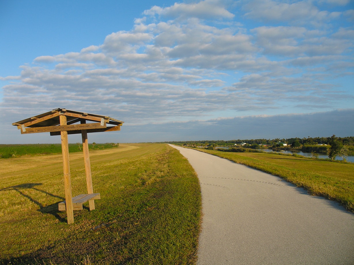 Florida Trail, Port Mayaca to Henry Creek 14 miles. In an arc between ancient natural shoreline and expansive waters, this hike along Lake Okeechobee's eastern shore offers unparalleled vistas.
 Rafael Sanchez Trail In a narrow slice of forest atop the relict shoreline of Lake Okeechobee, the Rafael Sanchez Trail stays in deep shade for its 5.7 mile linear traverse of the rocky Okeechobee Ridge.
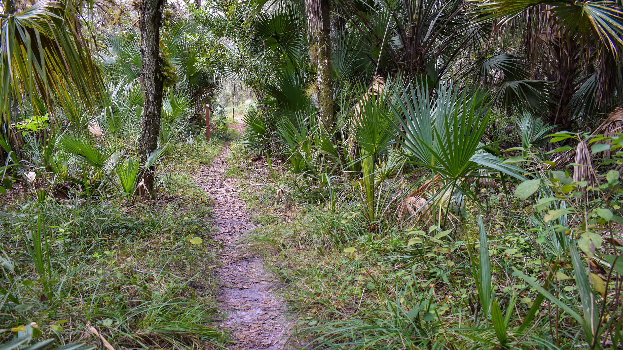 South Fork Nature Trail Along one of the Treasure Coast's most scenic waterways, the South Fork Nature Trail shows off the best side of the South Fork of the St. Lucie River.
- Myakkahatchee Creek Environmental Park - April 6, 2025
- Crews Lake Wilderness Park - March 31, 2025
- Cary Nature Trail - March 30, 2025