As the St. Johns River snakes its way north of Titusville, it passes through a series of vast marshes and lakes well known to regional residents.
These include Puzzle Lake, Lake Harney, Lake Jesup, and Lake Monroe at Sanford.
But unless you’re a boater, you don’t see the connections between them, as few roads reach or cross the river because of its massive floodplain.
Hickory Bluff Preserve offers a peek at one of these lesser-known segments of the St. Johns River from a surprisingly tall bluff.
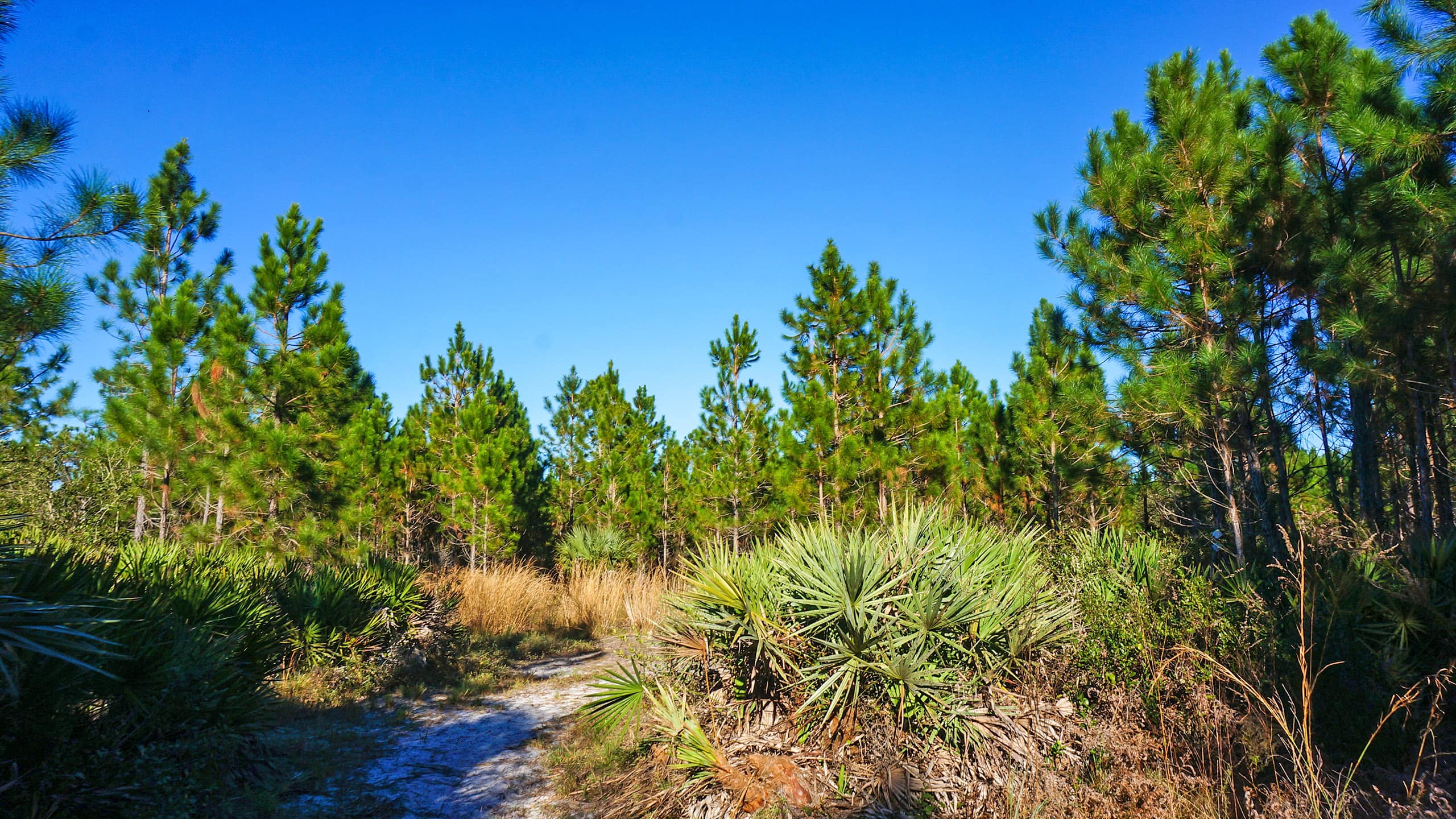
 Following the trail down a saw palmetto corridor
Resources


Disclosure: As authors and affiliates, we receive earnings when you buy through our links. This helps us provide public information on this website.
Overview
Location: Osteen
Length: 1.5 mile loop
Trailhead: 28.8322, -81.1186
Address: 598 Guise Road, Osteen
Fees: Free
Restroom: None
Land manager: Volusia County
Phone: 386-736-5953
Open sunrise to sunset. Leashed pets welcome. Hikers, off-road cyclists, and equestrians share the trails. The trails have soft sand so biking them isn’t easy.
Camping facilities – including a portable toilet, fire ring, benches, and picnic shelter – exist on the bluff for the use of organized groups. Obtain a permit in advance by calling ahead.
Directions
From Sanford, follow SR 46 east to SR 415 and head north. Or, from Deltona, take Howland Blvd to SR 415 and head south. Follow Florida Ave/Osteen-Maytown Rd east. Drive 2.7 miles to Guise Road and turn right. Continue down this narrow residential road for a little under a mile to the preserve entrance on the right.
Hike
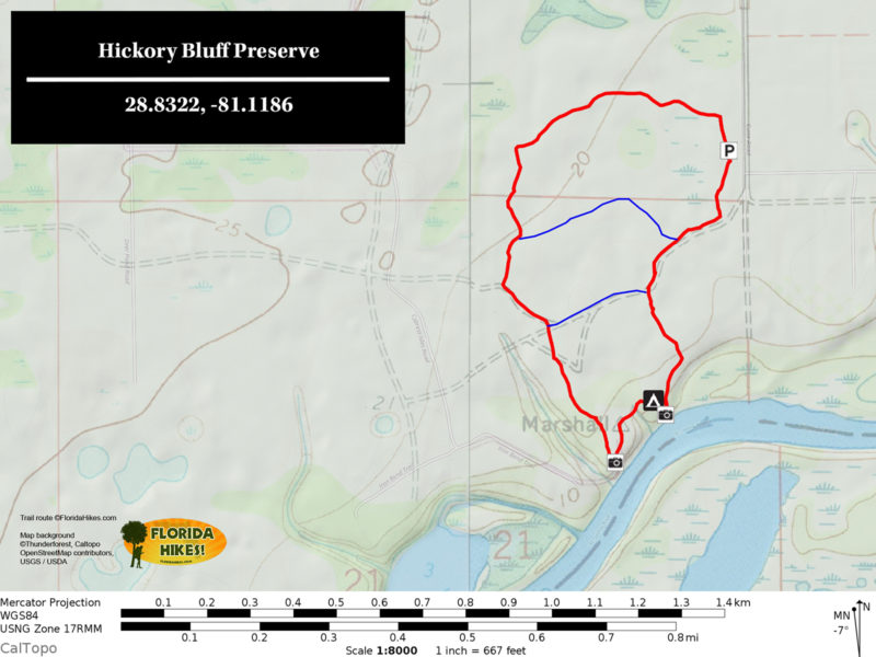
Start your hike near the kiosk, where a sign with a map shows the route. Two loops make up the trail system.
The mile long River Trail (Blue Trail) is blazed blue. It goes out to the bluff. The Red Trail forms an extension to it for a longer loop back to the other end of this trailhead.
 Trail map near kiosk
Starting out in pine flatwoods with a dense understory of saw palmetto, the River Trail guides you past slash pines and sand live oaks.
Reaching a T intersection, the well-groomed surface ends. Turn right and the footpath becomes soft sand underfoot as it enters scrubby flatwoods.
 Start of the River Trail
Passing an interpretive sign about the four types of pines that grow here, look for trail markers on the trees.
A marker guides you past an unmarked side trail, after which you reach the top of the Blue Loop at a quarter mile.
Continue straight ahead. Beyond a bench is a small depression marsh surrounded by saw palmetto.
This damp area quickly yields to scrub forest, the trail lined with saw palmetto.
 Trail through the scrub
At the next junction, continue straight ahead into a shady oak hammock. The trail emerges onto an old road. Turn right.
Within a few moments, you draw within sight of the St. Johns River. The path leads past a campfire circle to a low, gentle slope to a beach on the river.

After enjoying the view of the far shore, walk back uphill and hang a left past the campfire circle.
Continue through the forest beyond the covered pavilion, where a rough trail leads past a blue trail marker towards benches along the river.
 Campfire circle on the bluff
Here, you see for yourself that Hickory Bluff is a bluff, not a midden. It’s high enough above the river to provide a nice panorama.
Take in the view, and exit via the sandy corridor leading away from the river.
 Standing atop Hickory Bluff
Leaving the river, you see numerous trail markers. The sand in the footpath may be deep and churned up.
A younger forest tops the bluff, perhaps replacing a homestead from long ago. Scattered older live oaks anchor the landscape.
At a fork in the trail at 0.7 mile, keep left to follow the blue markers. An interpretive sign about gopher tortoises is adjoined by a burrow.
A bench sits in the shade of a moss-laden water oak just before the trail enters a broad tunnel shaded by sand live oaks and rusty lyonia.
 A turn along the Blue Trail
Emerging from the shade, you encounter the next bench. The trail passes tall blueberry bushes and an interpretive sign on animal tracks.
A decision point is at a four-way junction of trails. The Blue Trail turns right. Continue straight ahead to start following the Red Trail.
 Trail through dense understory
Meandering through a dense hardwood forest, the broad path is edged with bracken fern.
The Red Trail makes a sharp right to emerge into pine flatwoods. Watch for deer browsing in the open understory.
At one mile, you reach the next four-way intersection. A house is on the left, beyond the preserve boundary fence.
Follow the Red Trail straight ahead past a bench into the heart of the pine flatwoods.
 One of the benches along the Red Trail
Bog buttons grow in the footpath as you pass another bench at 1.2 miles.
The trail marker at the T intersection guides you to the right into scrubby flatwoods.
At a line of pines, the trail enters a shady area under tall pines and an understory of oaks. A wall of saw palmetto adjoins the footpath.
When you reach the orange gate, you’ve completed the Red Trail. Walk around it and turn right to head back down to the kiosk where you started, wrapping up this 1.5 mile hike.
 Pine flatwoods along the parking area
Trail Map

Explore More!
Learn about the East Central Regional Rail Trail. It crosses Guise Rd near Maytown Rd, so Hickory Bluff Preserve serves as an off-trail parking area.
 East Central Regional Rail Trail Spanning 36.2 linear miles across southern Volusia County, the East Central Regional Rail Trail offers a long ride that also makes up a portion of several major Florida bike trails.
Related Articles
 Biking around Osteen Using Beck Ranch Park as our launch point for a cycling adventure in Osteen, we discovered how easy it was to stitch together the local network of bike paths into a pleasant ride, with the Osteen Diner right at hand for lunch.
 New perspective on the St. Johns River Just east of Osteen, Hickory Bluff Preserve provides a new perspective on the St. Johns River from above, its loop trail winding along bluffs and down to a riverbank.
Slideshow
See our photos of Hickory Bluff Preserve
Nearby Adventures
 Wiregrass Prairie South Loop Circling a panoramic landscape of pine savanna, this 3.3-mile hike at Wiregrass Prairie Preserve features colorful wildflowers and expansive views.
  Kratzert Trail For a quick dip into the beauty of the St. Johns River floodplain, the 1.6 mile Kratzert Trail offers a walk beneath ancient oaks and cabbage palms of enormous size.
 Palm Bluff Conservation Area Discover a parade of habitats in the Deep Creek basin on three loop hikes within 3,300 acres east of Deltona.
 Deep Creek Preserve Restoring a ranch back to natural habitats takes time, but brings to life the natural beauty of these soggy habitats in the Deep Creek basin near Lake Ashby.
