

The only free-flowing waterway connected to Lake Okeechobee, Fisheating Creek winds across an assortment of pastures and wild landscapes along its length of over 40 miles.
Located along US 27 on its north banks, Fisheating Creek Outpost offers camping and day use access to the cypress-lined blackwater creek.
A 0.3 mile long section of the Knobby Knee Trail focuses on accessibility from the parking area to the creek, showcasing bottomland forests and an abundance of cypress knees.
Near the end of the boardwalk, a well-marked loop trail explores seasonally flooded swamps and shady oak hammocks.
 Along the boardwalk
Resources


Disclosure: As authors and affiliates, we receive earnings when you buy through our links. This helps us provide public information on this website.
Overview
Location: Palmdale
Length: 1.7 miles
Trailhead: 26.939417, -81.319472
Address: 7555 US 27 North, Palmdale
Fees: $4 per person, waived if camping.
Restrooms: Yes, at the Outpost near the trailhead
Land manager: FWC / Fisheating Creek Outpost
Phone: 863-675-5999
Open Mon-Thu 9AM-5PM, Fri 9AM-8PM, Sat 8AM-8PM, Sun 8AM-5PM. Well-behaved pets allowed, additional $2 entrance fee per pet.
Jan through May are the best months to hike this trail if you wish to keep your feet dry.
Directions
This hike is located inside Fisheating Creek Outpost, which is just north of SR 29 along US 27 in Palmdale, 16 miles north of Moore Haven on the west side of the highway.
Hike
Starting at an accessible parking space next to the group camping area, follow a concrete sidewalk to a metal gate at the trailhead.
The paved walkway continues down a grassy causeway for a tenth of a mile before reaching an impressive boardwalk decked with composite boards.
 Trailhead gate
While the elevated walkway is narrow, several pull-offs are built into the structure, allowing folks traveling in opposite directions to pass one another.
Dense clusters of ferns line the boardwalk as it ventures into the floodplain forest under the cover of cabbage palms, red maples and large oaks.
 Concrete walkway and boardwalk
Cypress knees dot the forest floor where tall bald cypress trees rise above the canopy. At a junction of trails at 0.3 mile, a set of steps descends from the boardwalk.
Turn left to follow the walkway for another 200 feet, ending at a viewing platform alongside the creek.
 Boardwalk through the floodplain
The overlook provides sweeping panoramic views of Fisheating Creek. Depending on recent rains and the time of year, it may not be just a wide flowing waterway.
When water levels are high, look out over a collection of braided streams and sloughs swarming across the floodplain.
 Fisheating Creek overlook
Return to the steps and leave the boardwalk. Blue blazes lead north along a shortcut back to the trailhead for a simple loop of 0.7 miles.
For the longer hike, follow the yellow blazes heading towards the creek.
Cypress trees increase in number and the understory transitions to grass as yellow blazes lead deeper into the floodplain, reaching the creek’s sandy banks in a quarter mile.
Turning north to parallel Fisheating Creek, follow trail markers as the route winds through a labyrinth of trees with distinct waterlines a few feet up each trunk.
 Creekside oak
At 0.7 mile, a spur trail marked with blue blazes leads out to a scenic bluff overlooking a picturesque bend in the creek.
Taking this side trip adds 0.3 miles to the overall length of the hike. The views are certainly worth the detour.
 View from the bluff
Return to the main loop. A worn track crosses a pasture of tall grasses towards an oak hammock where the path turns east at a barbed wire fence.
The trail skirts along the fence line for the most part, passing huge live oaks covered with bromeliads and Spanish moss, before finishing the loop portion at 1.6 miles.
From this point, follow the sidewalk for another tenth of a mile back to the trailhead.
 Live oak laden with air plants
Trail Map

Explore More!
Learn more about Fisheating Creek WMA
 Fisheating Creek WMA In the wilds of South Central Florida, Fisheating Creek has always been a favorite for paddlers. Four trails also provide access for hikers to enjoy these lush surroundings on foot.
Video
Hiking the Knobby Knee Trail
Slideshow
See our pre-boardwalk photos from this hike
Nearby Adventures
 Gatorama Started in 1957 as a roadside attraction to show tourists one of the two Florida experiences they wanted - alligators! - Gatorama still has that funky Old Florida feel.
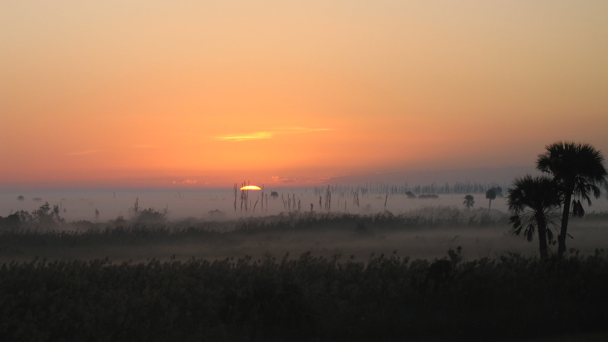 Florida Trail, Moore Haven to Lakeport Leaving the Caloosahatchee River to dip through the Fisheating Creek floodplain, this hike on the western side of Lake Okeechobee is all about the marshes.
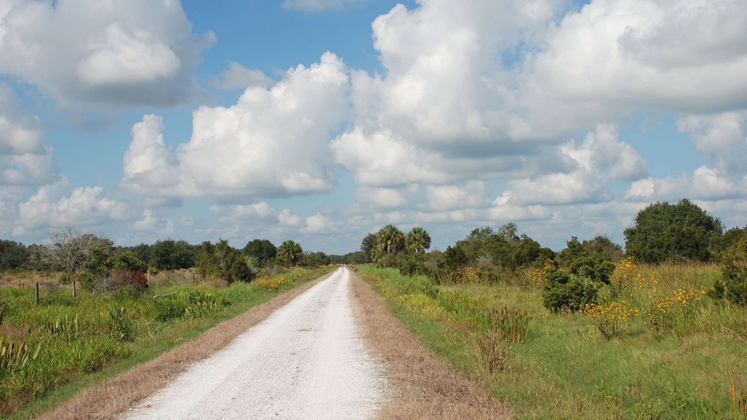 Fort Center Explore Fort Center, a pre-Colombian village lost in Florida’s past – and uncovered again by archaeologists – by following this trail in Fisheating Creek WMA.
  Archbold Biological Station A pair of short loops provide close observations of rare scrub habitats at a historic research facility on the Lake Wales Ridge south of Lake Placid.
- Lake Godwin Loop - May 12, 2025
- Black Creek Ravines Conservation Area - May 9, 2025
- Moses Creek Conservation Area - May 5, 2025