

Yes, this trail is named for a truck rusting away in the woods. Providing a different take on the uplands around Charlotte Harbor, the Old Datsun Trail shows how nature recovers from agriculture.
In 1905, this was the location of the Miles School of Practical Agriculture and Free School for Truckers, with vegetable farms as far as the eye can see.
Given the size of the live oaks along this loop through Charlotte Harbor Preserve State Park, it’s simply amazing that anything was ever here but a forest.
Resources
Resources for exploring the area

Disclosure: As authors and affiliates, we receive earnings when you buy these through our links. This helps us provide public information on this website.
Overview
Location: Punta Gorda
Length: 1.4 mile loop
Trailhead: 26.851145, -82.022075
Address: 12301 Burnt Store Rd, Punta Gorda
Fees: Free
Restroom: None
Land manager: Florida State Parks
Phone: 941-575-5816
Open sunrise to sunset. Leashed dogs and bicycles permitted. Mosquito repellent strongly recommended.
This is the only trail within the park that is near the park office. It is 1.5 miles south along Burnt Store Rd from Alligator Creek Preserve, so it’s worth hiking both in the same day. There is no connector between them.
Directions
From Interstate 75 exit 161, head west on CR 768 for 1.3 miles, which becomes CR 765 (Burnt Store Rd) just before crossing US 41. Continue another 2.7 miles to the trailhead entrance on the right.
Hike
Pick up a trail map at the kiosk and follow the trail to the right, guided by arrow signs. Step over a gopher tortoise burrow as you walk along the footpath. At the T intersection, turn right.
The purple blooms of spiderwort and bright pink puffs of sensitive brier peep up from the tall grass as you enter the cabbage palm flatwoods.
Slash pine makes up the high canopy, with cabbage palms and scattered oaks below. The loop starts at 0.2 mile. Turn right.
Notice how the ground seems to be furrowed beneath the vegetation, signs of the former vegetable farms that occupied this land.
The footpath can be a bit indistinct, but the arrow markers are placed so you don’t lose your way.
At the T intersection with a jeep trail, turn right. Skirting an oak hammock shrouded in deep shade, the trail curves right.
Making a left past a slash pine with a thick trunk, the trail passes a bench under the shade of the live oak hammock and continues into a dense palm hammock.
To the left, beyond the trees, is a hint of a large freshwater marsh with yellow cannas and marsh mallow clustered around the edges. The footpath may be damp as you round a corner past the marsh.
In a palm hammock, the trail cuts a corridor through the thickening understory of saw palmetto. Passing a bench at 0.8 mile, the trail turns to the left.
Cross a bridge over a sluggish stream draining the wetlands. Continue past a bench in the shady palm hammock.
Take care as to where the trail goes. The path twists and curves between the cabbage palms, turning sharply.
Reach the next bench at 1 mile. The trail continues through a string of cabbage palm hammocks, alternating stretches of open sun with deep shade.
Twisting and winding in and out of the hammocks, the trail passes another bench. The jeep trail continues straight, but the hiking trail turns to the left into an oak hammock.
At the T intersection, turn left. Keep right at the fork, leaving the jeep trail for the mowed path. A few moments later, finish the loop.
Continue straight to return to the parking area. Make sure to turn left along the path when you see a paved road ahead. Reaching the parking area, complete the 1.4-mile hike.
Trail Map
 Old Datsun Trail Map
Explore More!
Nearby Adventures
More worth exploring while you’re in this area.
 Alligator Creek Preserve A series of loop trails radiate from Charlotte Harbor Environmental Center, exploring upland habitats and wetlands where freshwater and saltwater ecosystems converge.
  Ponce De Leon Park A city park with dramatic sunsets over a beach on Charlotte Harbor, Ponce De Leon Park is a delight for birders and paddlers, too.
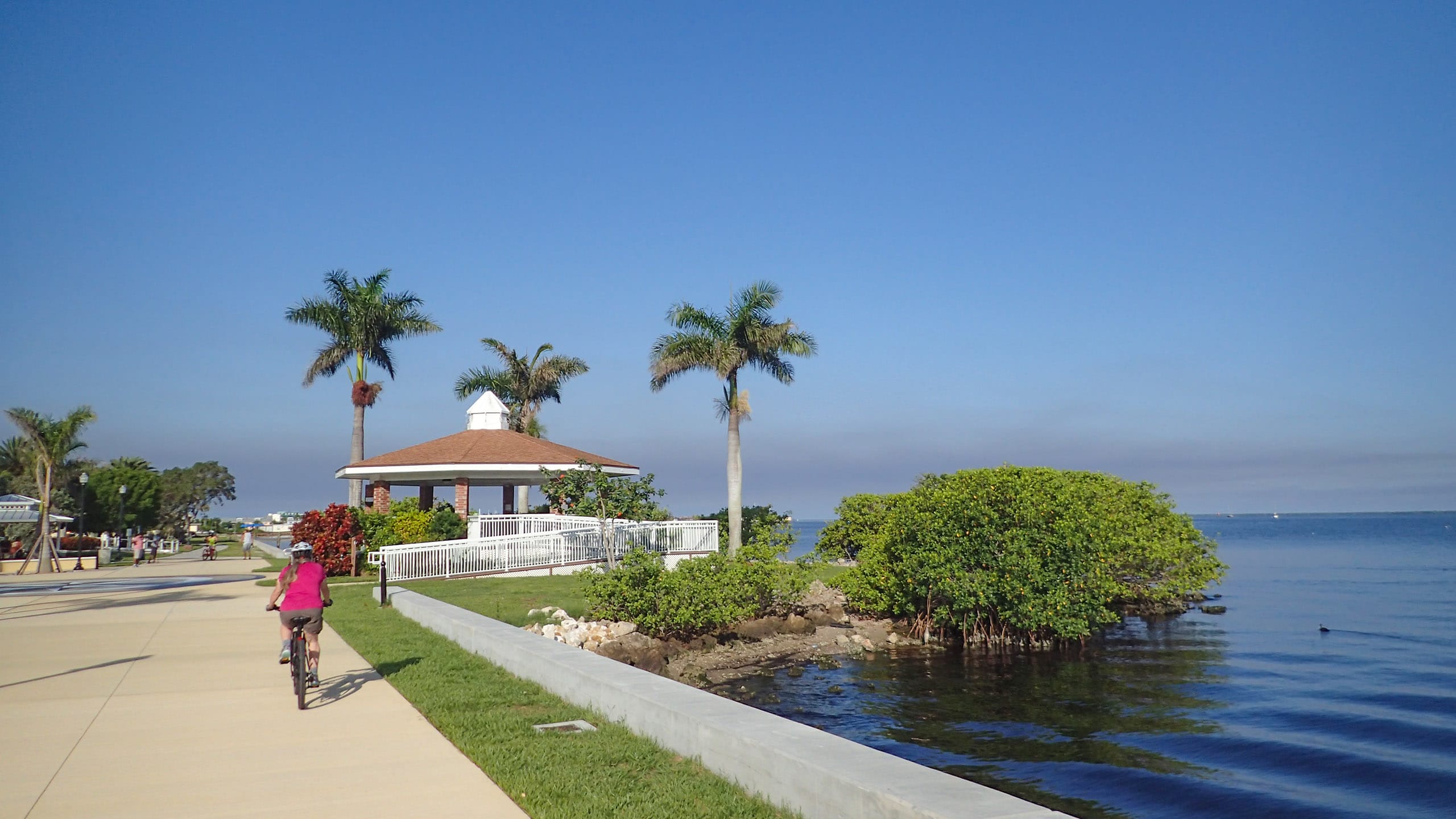 Punta Gorda Harborwalk Spanning 2.3 miles along Charlotte Harbor, the Harborwalk is a recreational gem in downtown Punta Gorda
 Punta Gorda Linear Park A greenway through the heart of historic Punta Gorda, Linear Park provides an unexpected corridor of nature.
- Indrio Scrub Preserve - March 15, 2025
- Indrio Savannahs Preserve - March 15, 2025
- D.J. Wilcox Preserve - March 14, 2025